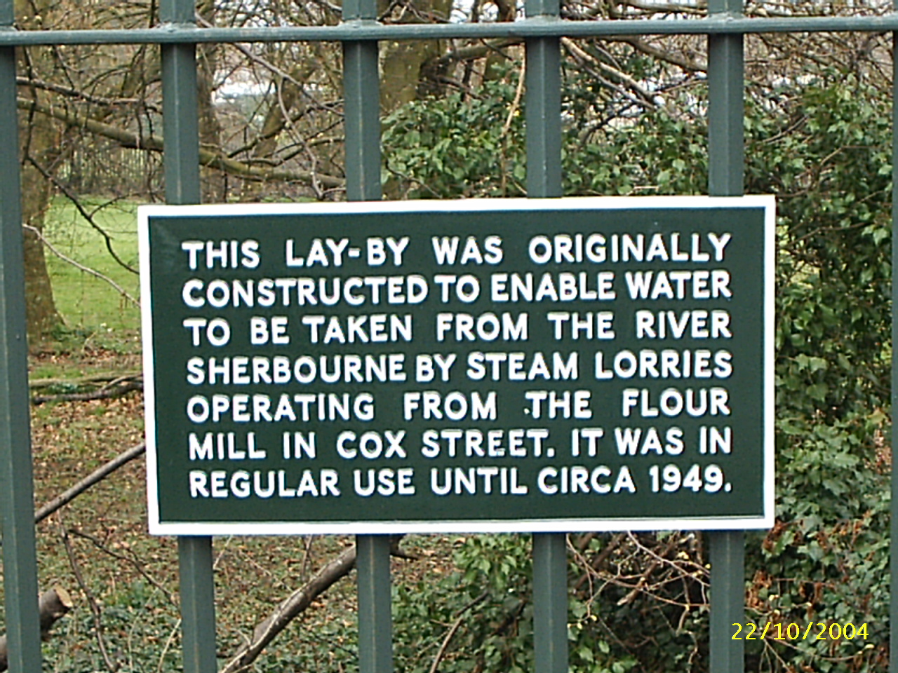
The River Sherbourne
This map is indicative only. Most of the important water features are included but not necessarily in the right place - but they are, generally, in the right order.
The River Sherbourne rises between Corley and the Meriden to Fillongley road. Meigh Woods is the source of the Pickford Brook and Bridle Brook first distinguishes itself in Watery Lane in Corley. The Sherbourne proper rises in a small pool to the east of Wall Hill Road just north of Pikers Lane. The North Brook rises near to the junction of Wall Hill Road and Hawkes Mill Lane and then flows south to meet the Sherbourne on the Coundon Wedge. The Bridle Brook meanwhile joins the Sherbourne at Hawkes Mill and flows south along Washbrook Lane and Butt Lane then under Staircase Lane to meet the North Brook on the far side of the Wedge. The river is then joined by the pickford Brook which has come down the central reservation of the Allesley Bypass.
The River Sherbourne then passes under the Holyhead Road into Lakeview park where it absorbs the Guphill Brook which has come from Banner lane via Mount Nod. The next contribution comes from the Radford Brook in Corporation Street. The Radford Brook once fed Naul's Mill but is now completely culverted. Springfield brook, also known as the River Arthur and Endemere Brook, once fed the Swanswell Pool and provided Coventry's main source of water for two hundred years. Springfield Brook came from Springfield farm on Penny Park Lane and the pool was near what is now allotments behind The Scotchill and Sadler Road.
The Spittal Brook, another small stream now completely culverted, came from the Swan Lane area and joined at Shut Lane Mill near what is now Gulson Road. In Whitley the Park Brook from Quinton Pool joined the Sherbourne which then merged with the River Sowe behind Baginton Mill.
This is the source of The River Sherbourne to the east of Wall Hill Road near Pikers Lane. It is in a shallow basin and drains the surrounding fields through ditches.
This is the source of the Bridle Brook in a field near Watery Lane in Corley Moor, only half a mile from the source of the Sherbourne.
The Bridle Brook heading south towards Hawkes Mill pool and its confluence with the River Sherbourne.
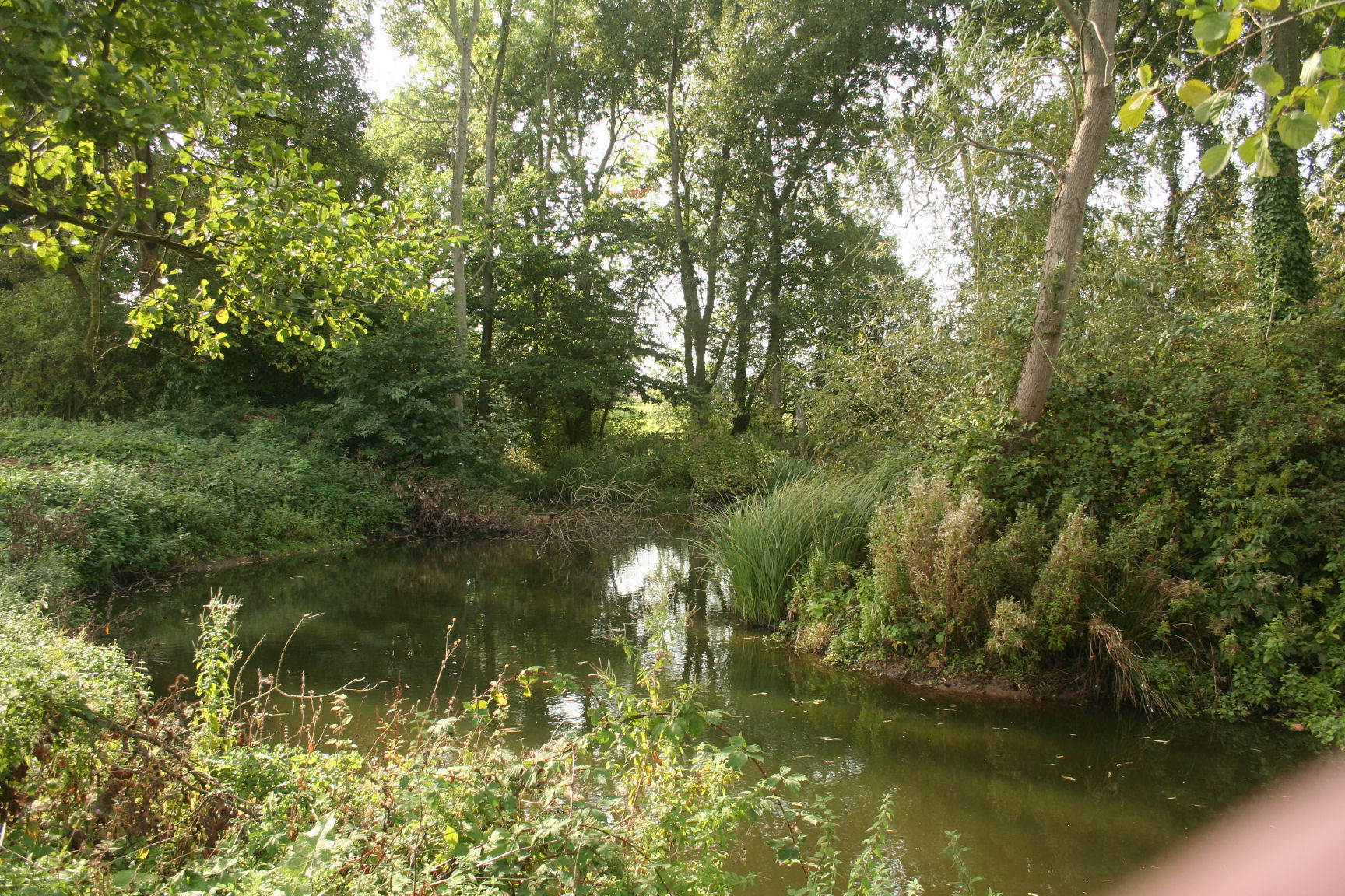
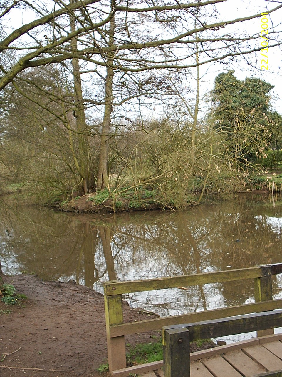
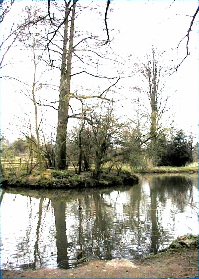
Hawkes Mill has at least three pools and this is the most pleasant.
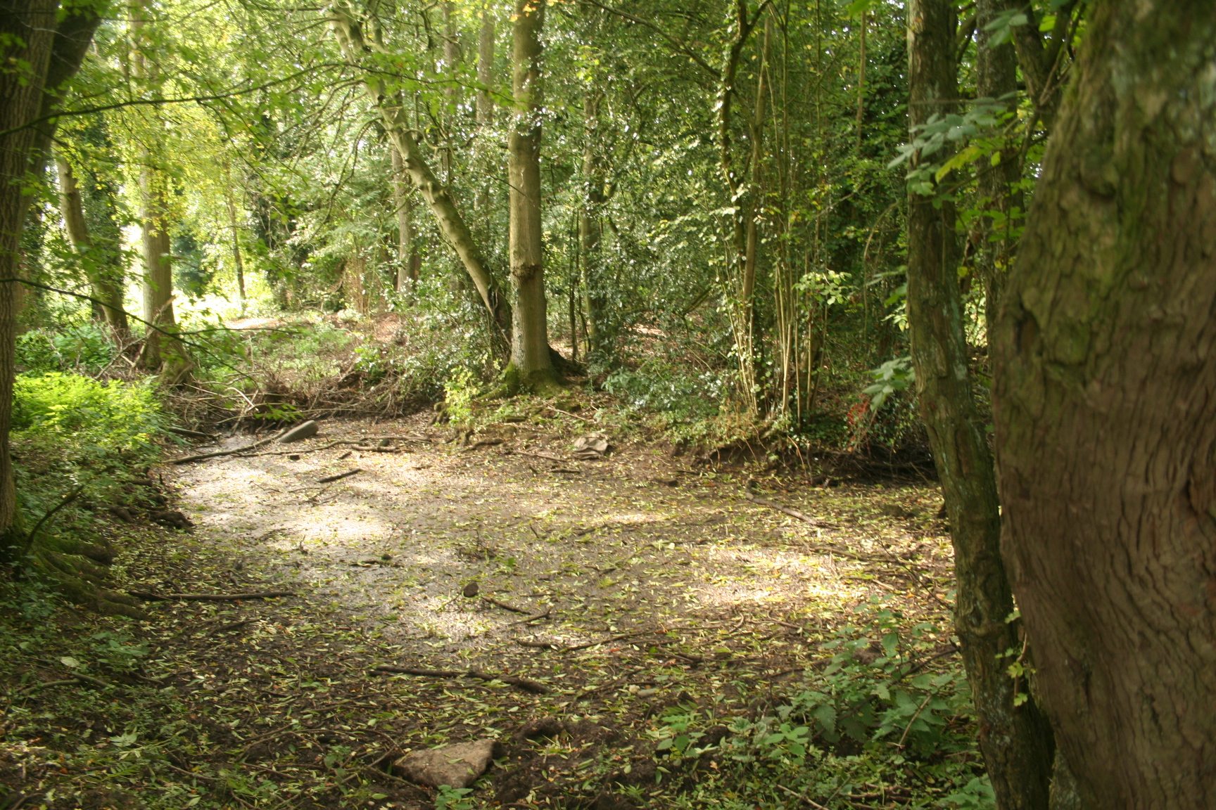
This pool has been drained and embanked and partially filled in.
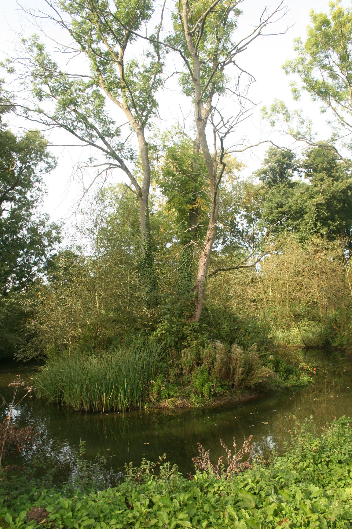
Another lovely view of the main pool at Hawkes Mill.
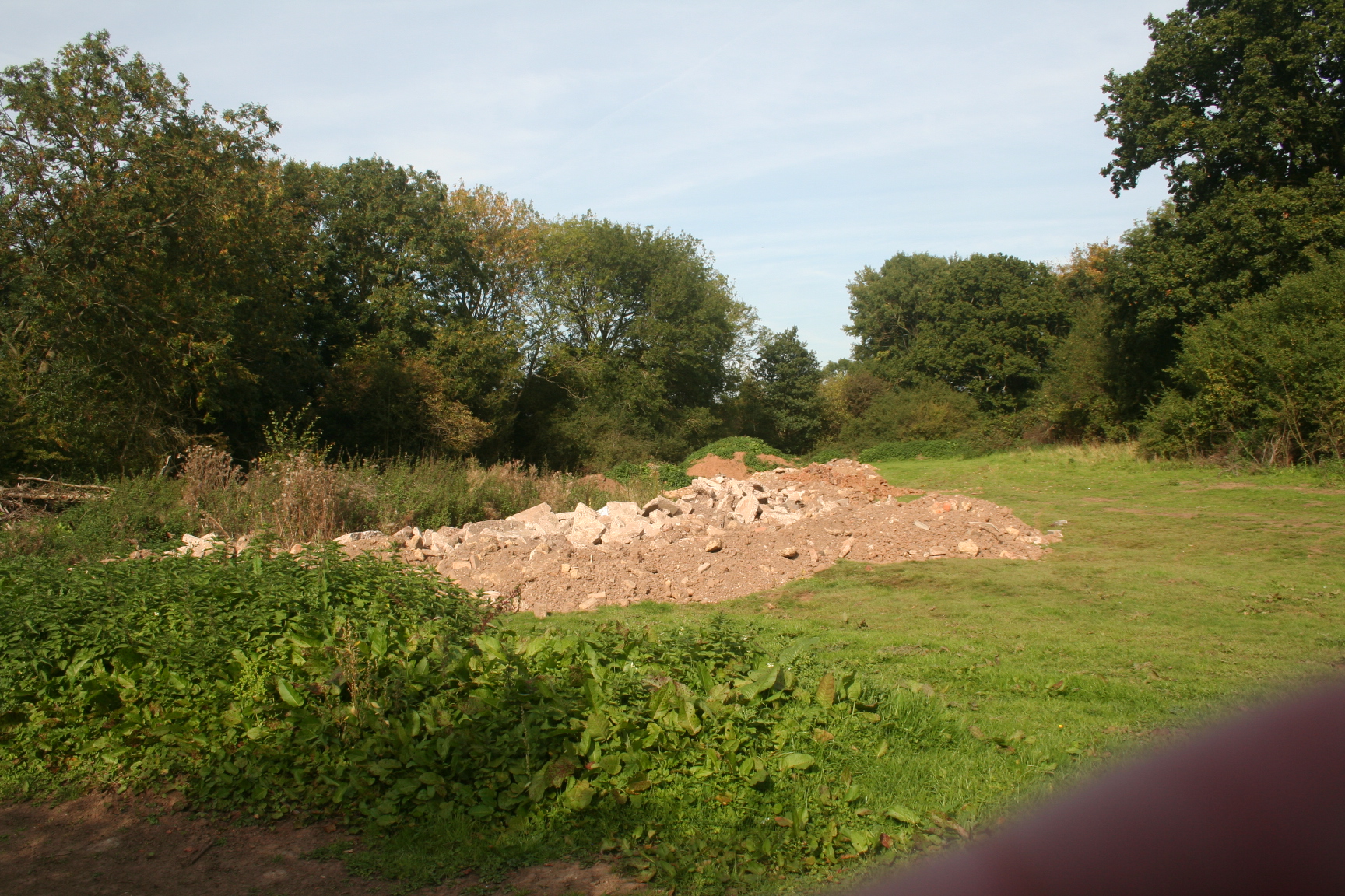
The field near to the pools has been extensively used for dumping builder's rubble.
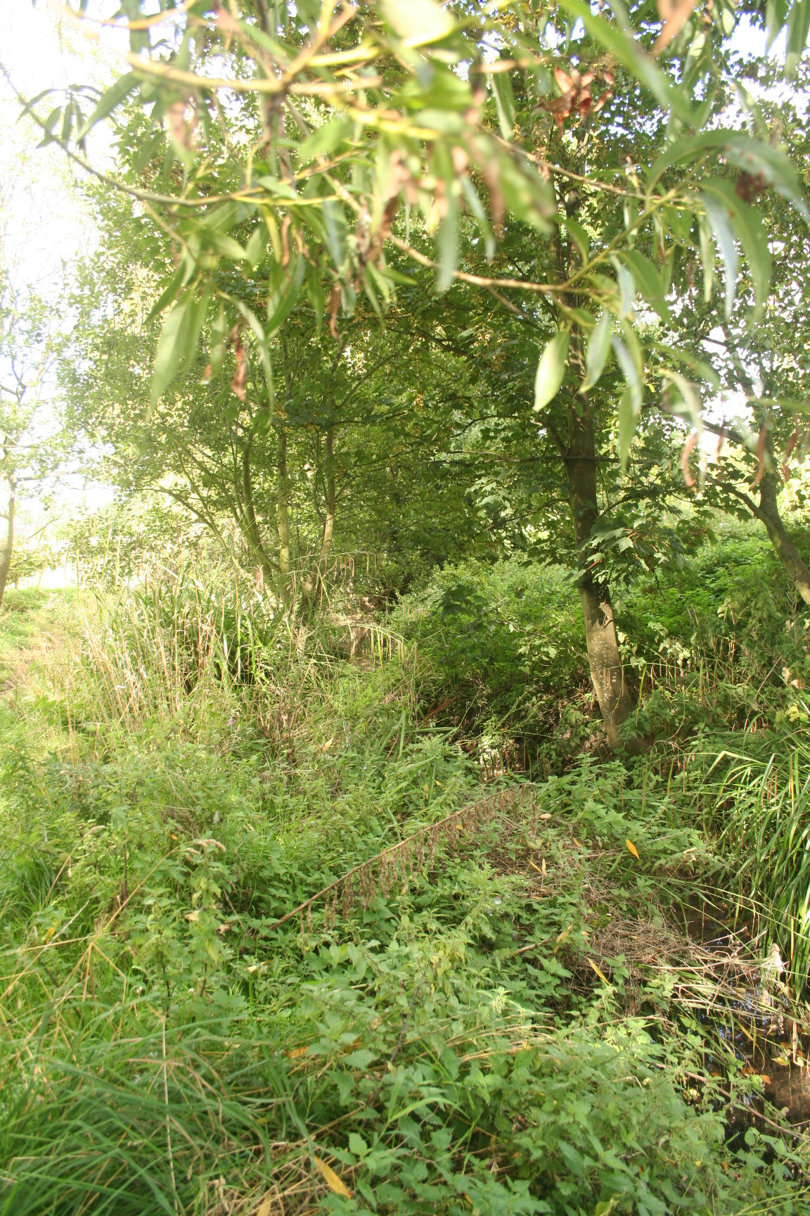
The River Sherbourne along Butt Lane in Allesley has been totally canalised and is totally uninteresting.
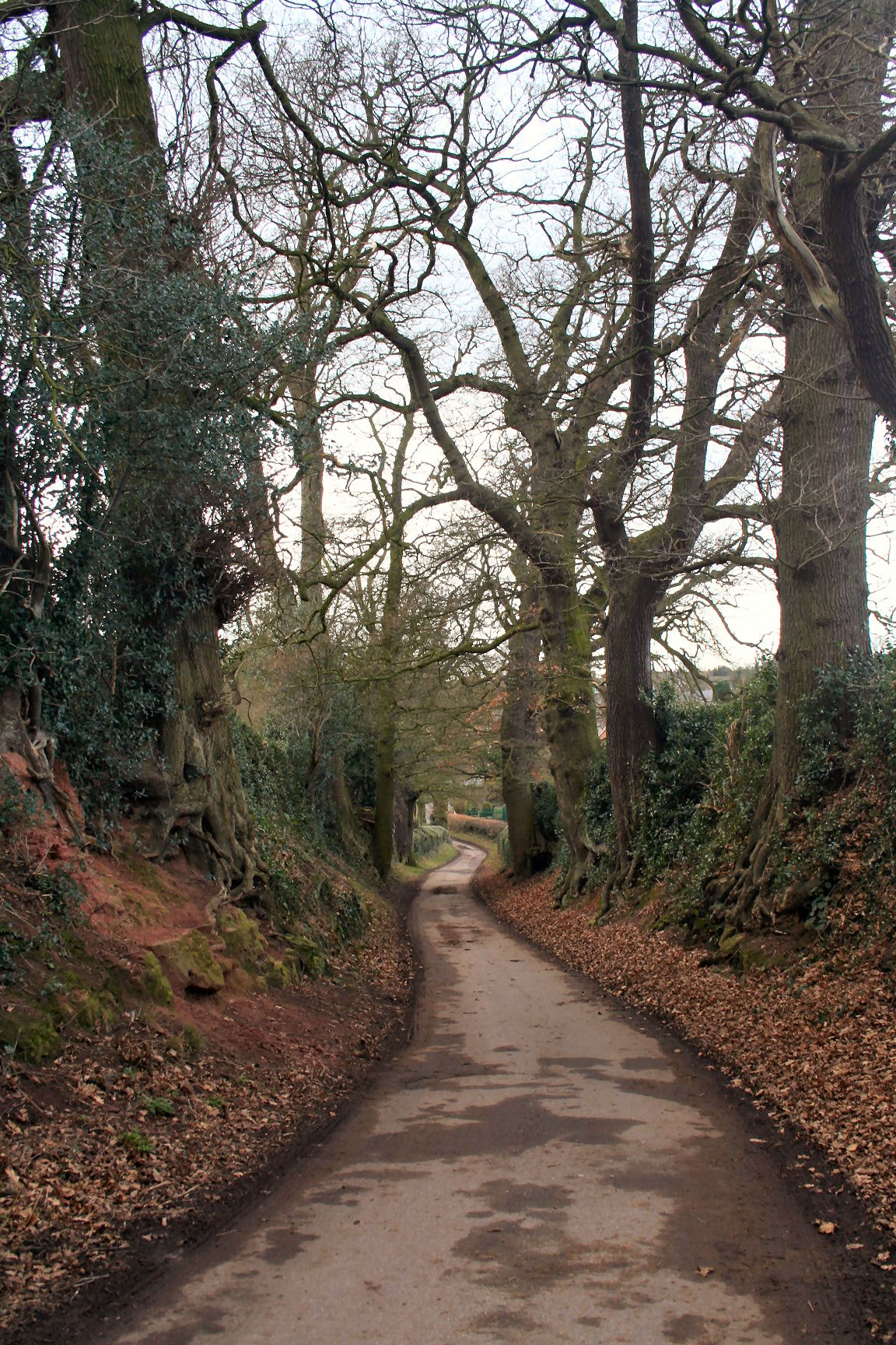
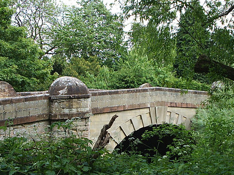
Staircase Lane in Allesley is probably the prettiest single view in Coventry and this is looking down towards the River Sherbourne bridge.
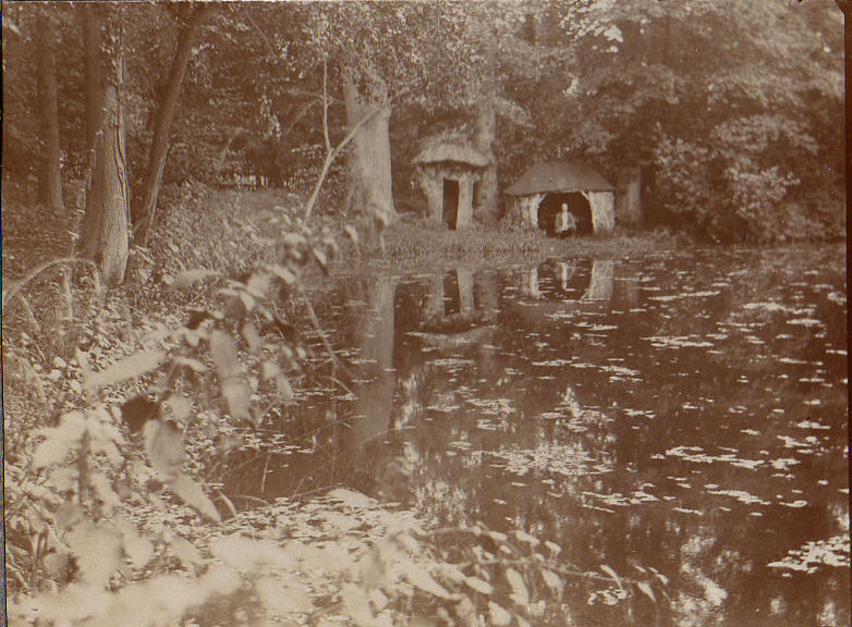
This fishing pool existed near to Staircase Lane until around 1930 and had various names and was well used by the local vicar, the reverend Bree, and others, for fishing. One of its names was The Frogmere. The owner has filled it with rubble. This photo was around 1900-1910. Courtesy David Fry.
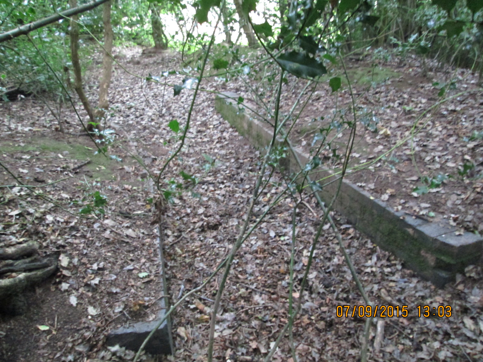
This is what the Frogmere looks like in 2011.

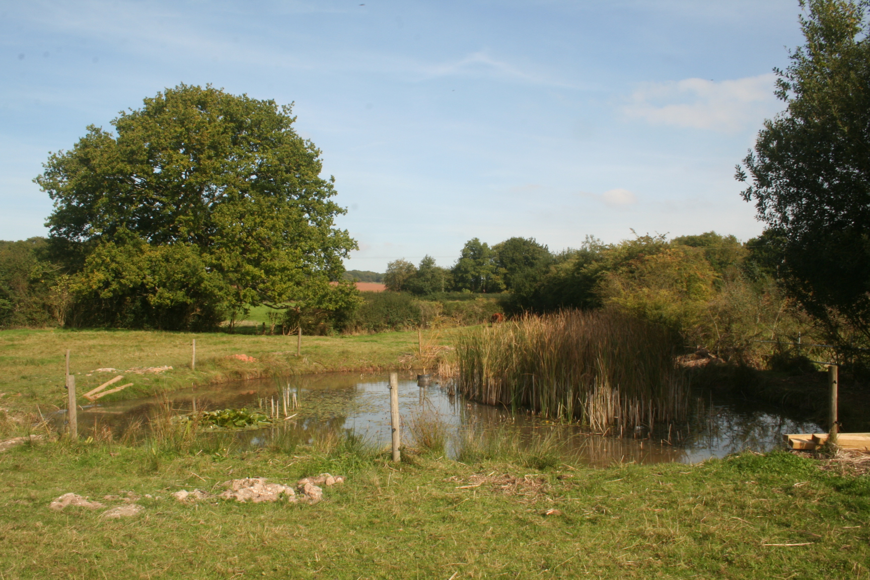
In the next field stands this well-built brick bridge which faciltates the passage of animals across the river.
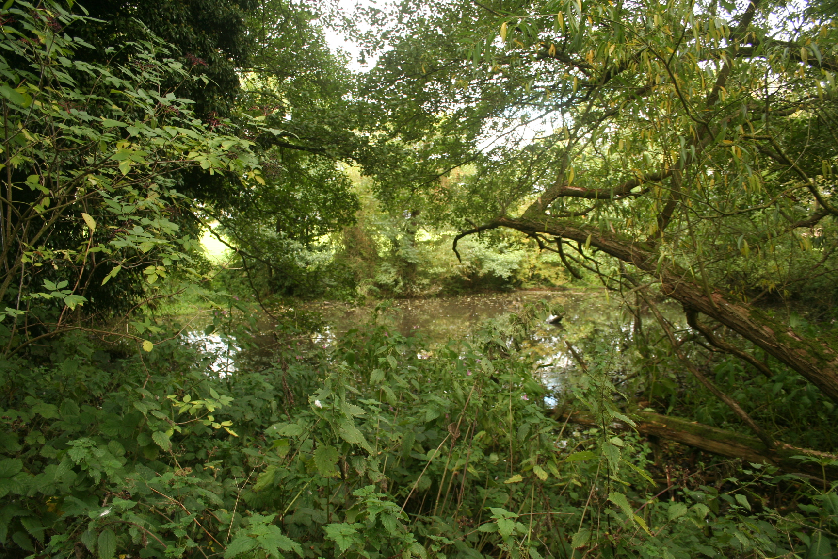
This is where Mole and Ratty lived although the willows are not in evidence just here.
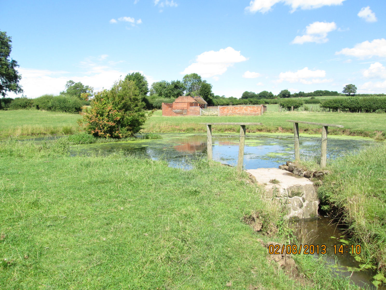
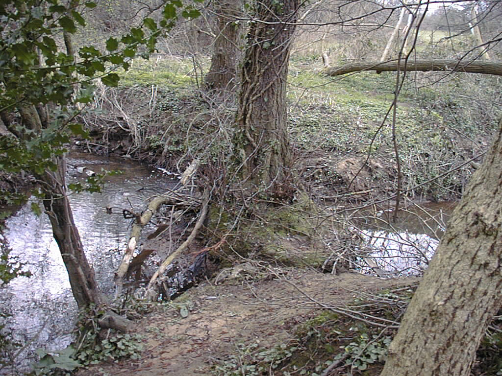
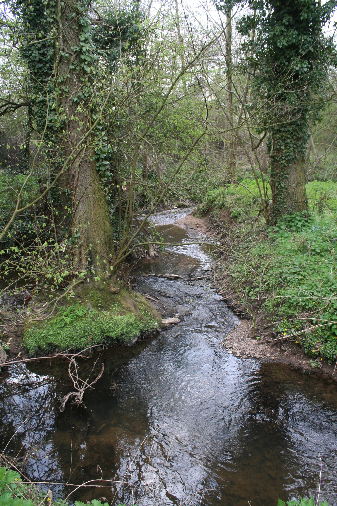
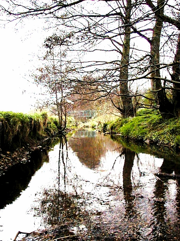
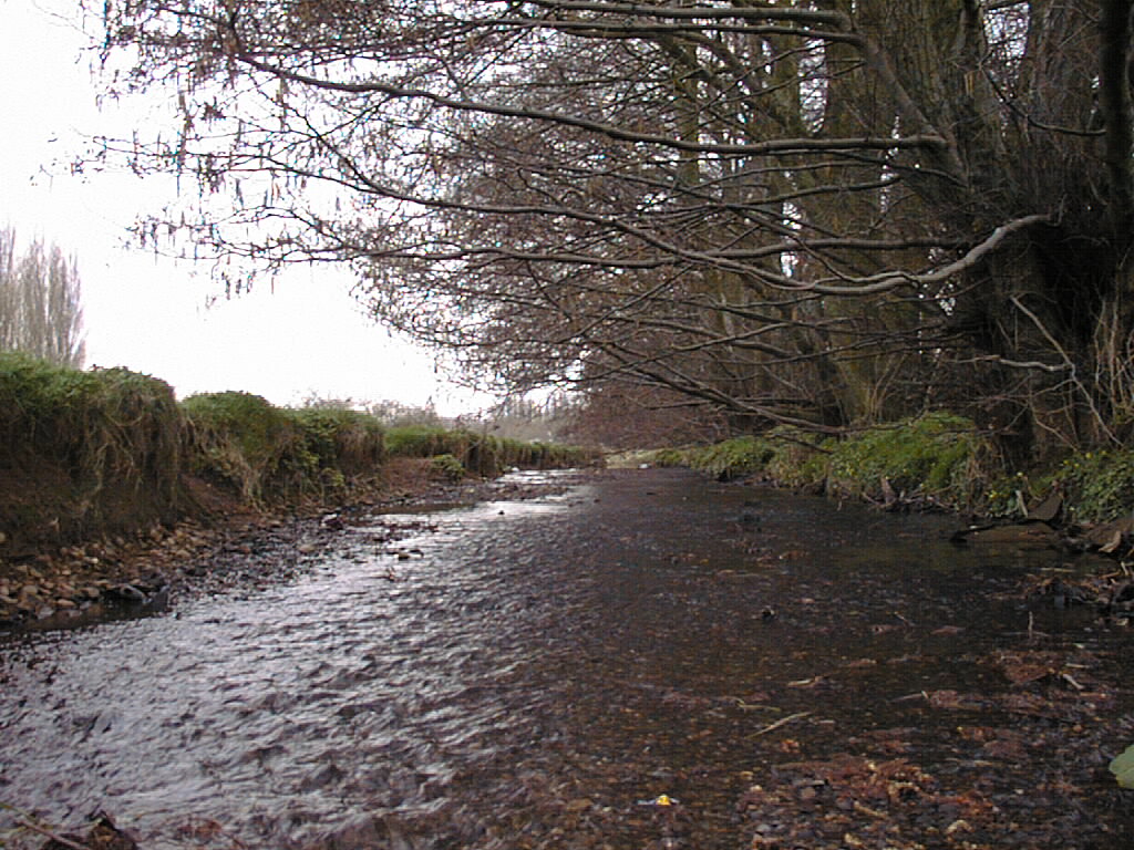
The river contains several meanders in this field and is a delightful example of a natural river. It also shows that water can be scarce in the summer.
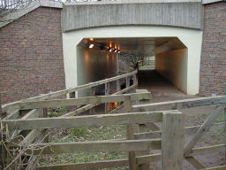
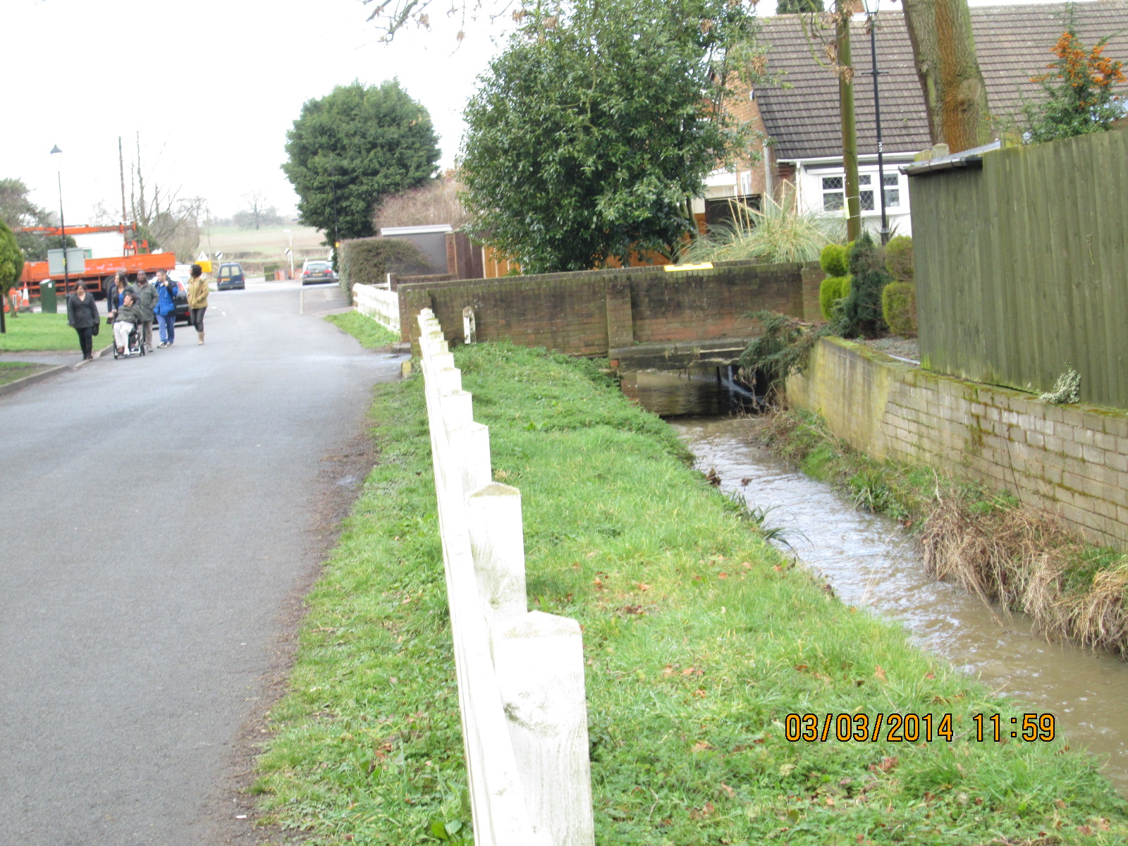
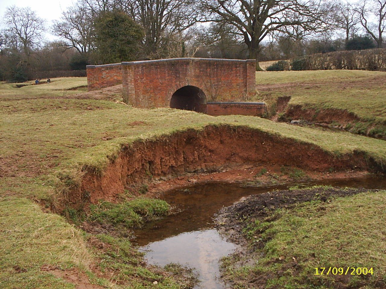
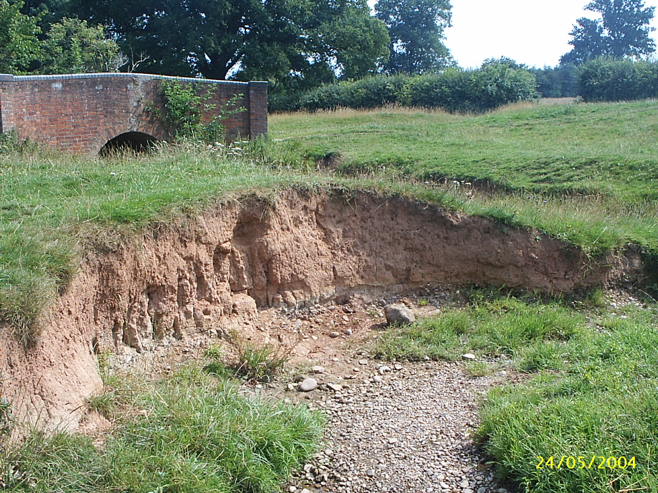
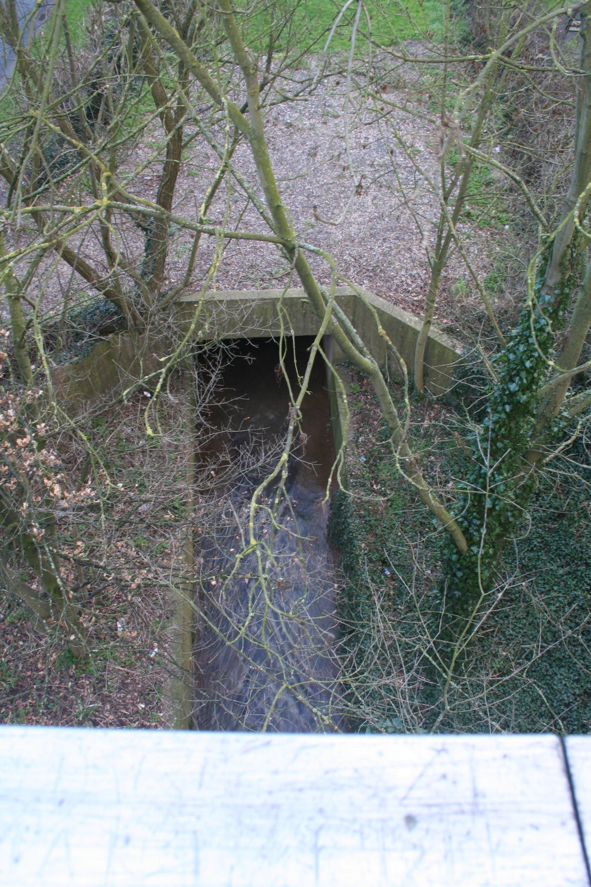
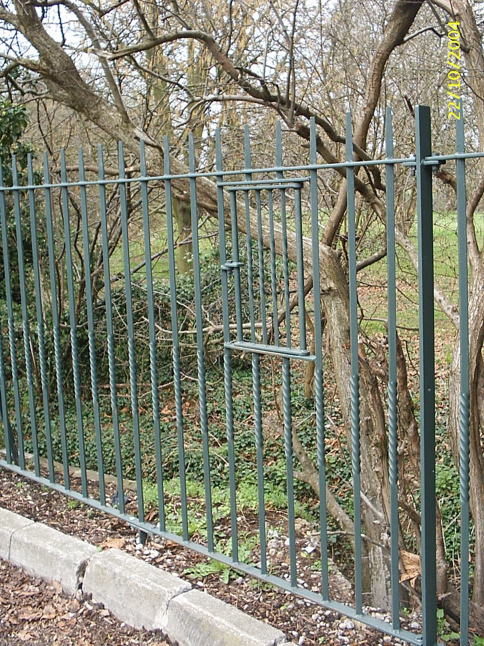
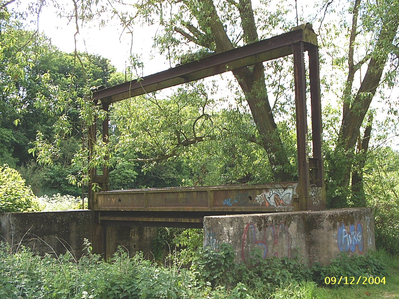
At the end of this delightful field the river is now constrained to pass under this monstrous concrete tunnel under the Coundon Wedge Drive.
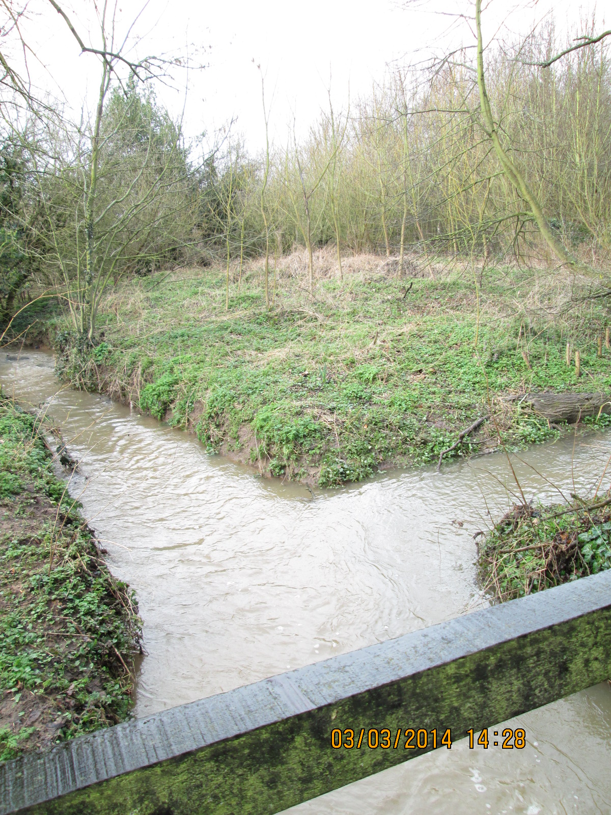
The confluence of the Sherbourne on the left and the North Brook on the right.
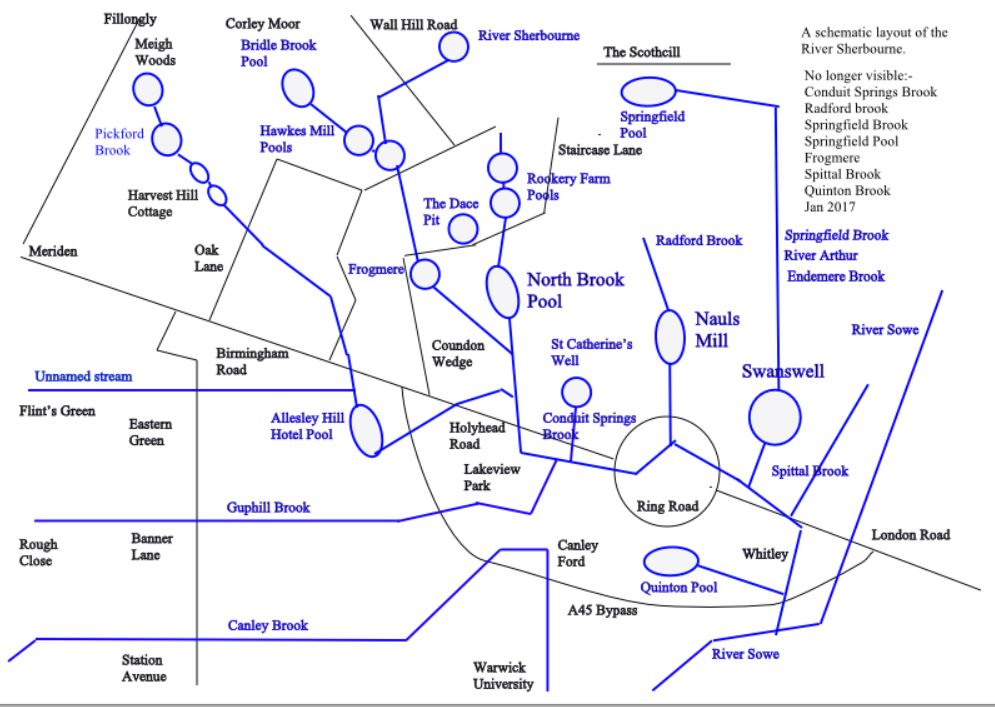
One of two pools on the North Brook at Rookery Farm in North Brook Road.
The North Brook heading south on the Coundon Wedge. The Course was partially drained in 1938 but is gradually becoming the marsh it should be.
The North Brook Pool was a boggy fenced area for most of the 20th century but was dredged and restored around 1970 by The Allesley and Coundon Wedge Conservation Society. In 2016 it again needs some dredging.
The pool was dredged in 2018 and this winter scene shows the stark colours.
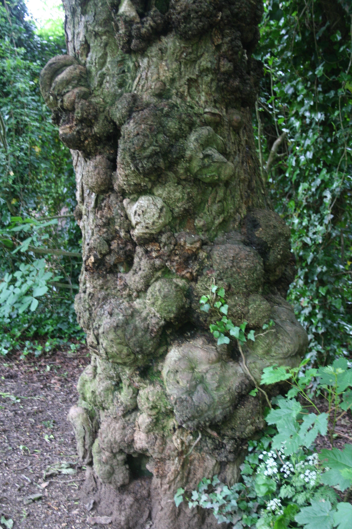
This is the ugliest tree on the Coundon Wedge but a wonderful display of symbiotic lifestyles. This is on the bank of North Brook Pool.
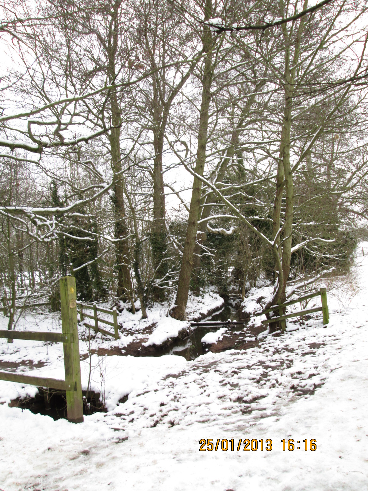
North Brook in the snow just above the pool.
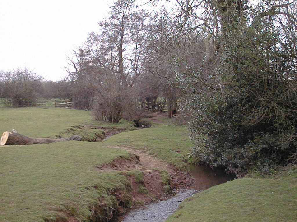
The North Brook in the field to the north of the pool is a very pretty and natural stream.
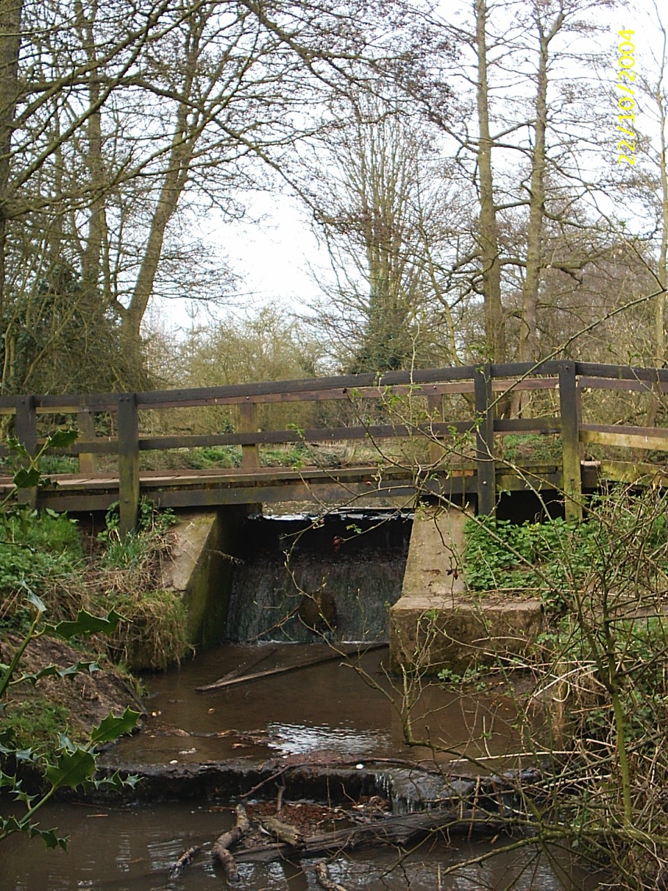
This is the weir that regulates the level of the water in the North Brook Pool and presents a serious obstacle to the movement of water-bourne wildlife.
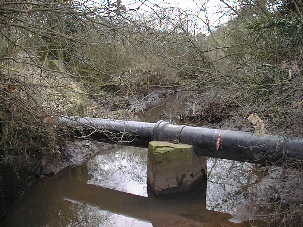
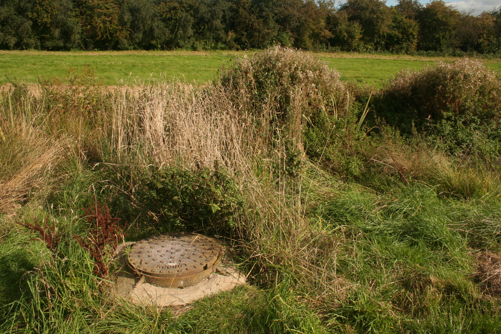
Just to the south of the confluence of Sherbourne and North Brook this pipe crosses the river and probably carries a good deal of Coventry's water supply from Meriden to Coundon Reservoir.
This pool is near the source of the Pickford Brook in Meigh Woods, Corley
This is the confluence of the Pickford Brook, right, which has just entered the Coundon Wedge from its constraint on the Allesley Bypass.
This footpath from Allesley Village to Allesley Hall passes over the Allesley Bypass and the concreted Pickford Brook .
The view over the bridge to the Pickford Brook

The pool on Pickford Brook within the Grounds of the Windmill Hotel at Alleseley
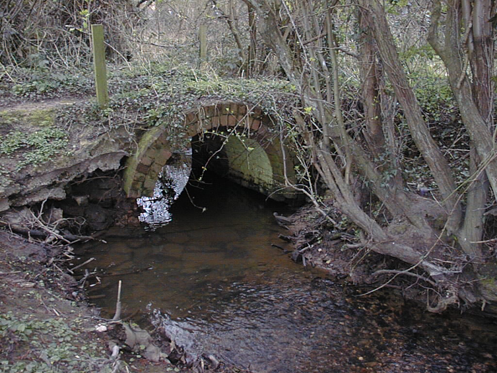
This decaying brick bridge is just downstream of the confluence of the River Sherbourne with Pickford Brook.
The natural course of the river in Sherbourne Fields
A few yards further downstream is this brick bridge which was built early in WW2 to carry a road to the Sherbourne Hostel which housed workers assigned to Coventry's many armament and aircraft factories. There were about 15 such hostels around the city and most of them functioned well into the 1960's. The site now houses Sherbourne Fields school.
Nearby on the Holyhead Road is this fence with two small gates just big enough for Pixies.
But the pixies never got to use them. Bah!
The river now has now crossed under the Holyhead Road and entered Lakeview Park. This is the second stretch of river just downstream of the top bridge and here has a pebble bed.

Nearby is a large electricity transformer station and it has been decorated by local youths. The wall is totally hidden and invisible from the park.
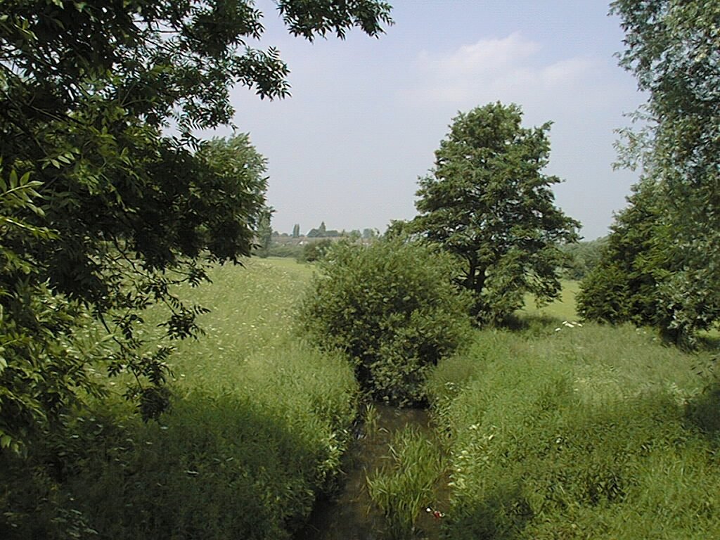
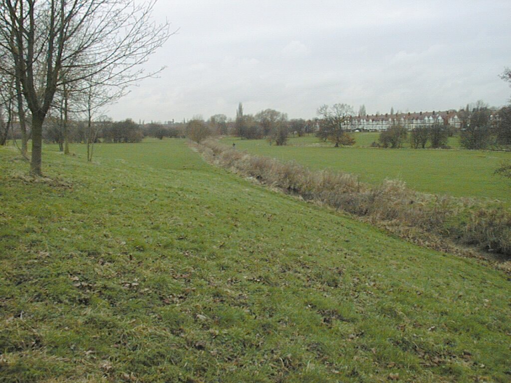
Another view of the broad, shallow , pebble bedded River Sherbourne in Lake View Park.
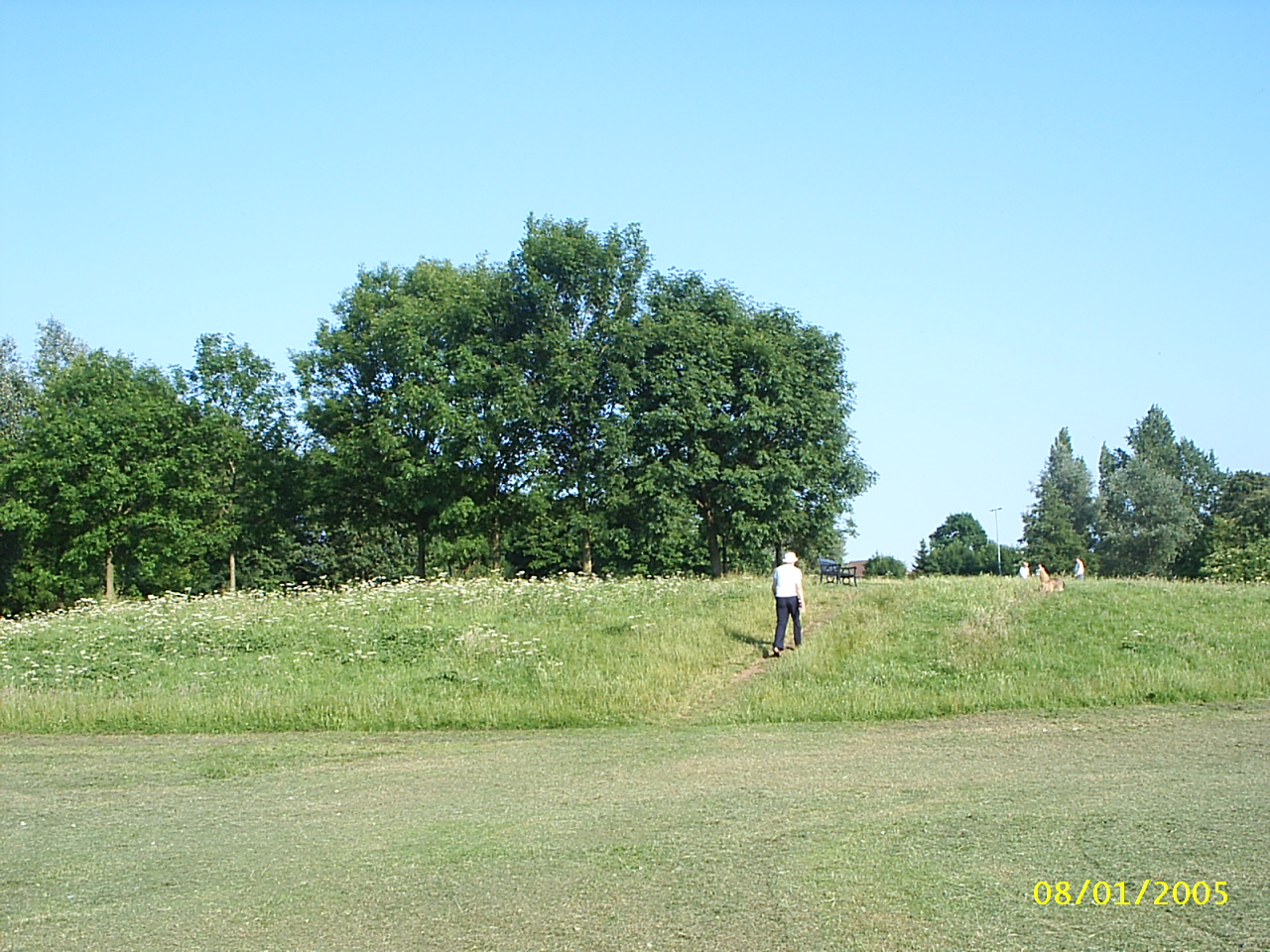
The wild area in Lakeview Park is rapidly developing
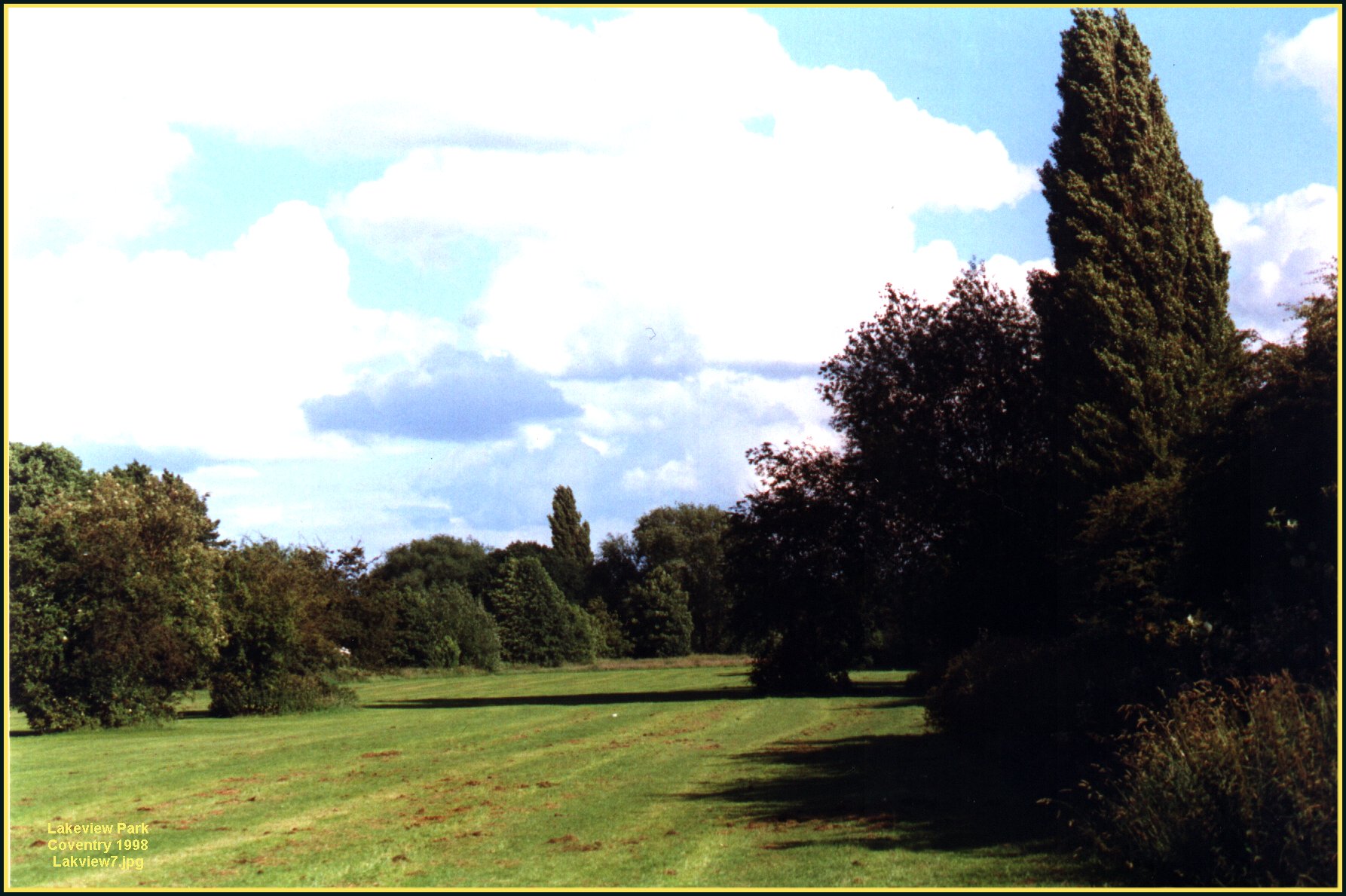
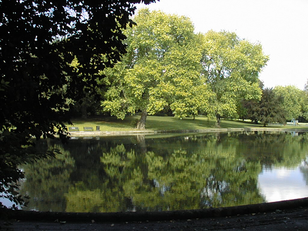
A view of Lakeview Park showing some areas that are being allowed to regenerate naturally. A BBC camera team making a documentary about parks thought this the best they had seen.
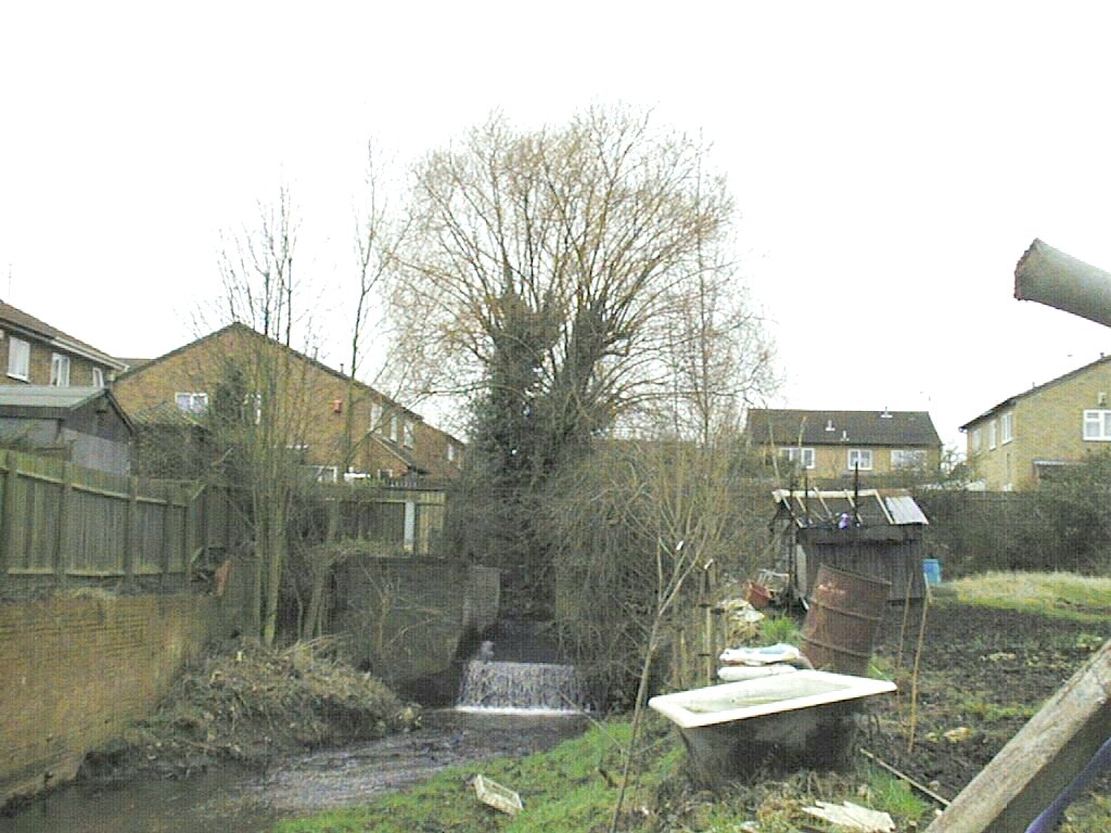
Looking north-west from Four Pounds Avenue along the mill stream. The former Spon End Mills are behind the camera.
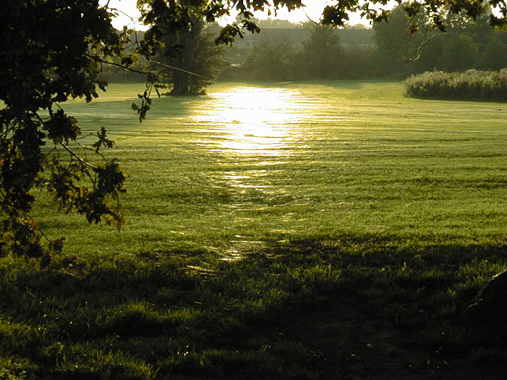
Looking towards the setting sun from the bank of the river in September. The park was covered in cobwebs - millions of them glinting in the sunshine. This is a common occurance in September.
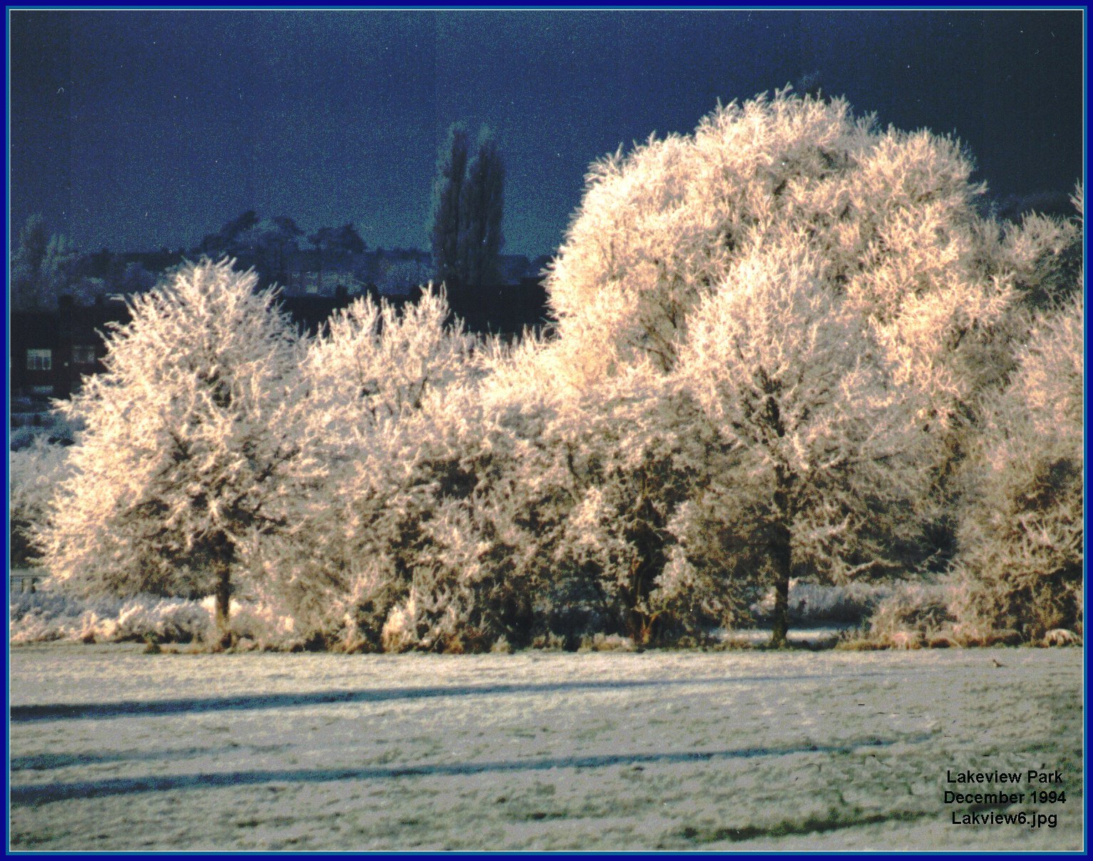
New Year's Eve around 1997 after a four-day frost in Lakeview park. The black sky turned into a thunder storm and an hour later the frost was gone.
The treeless mill stream starting it journey to Spon End Mill. Back right can be seen the trees marking the orignal river bed.
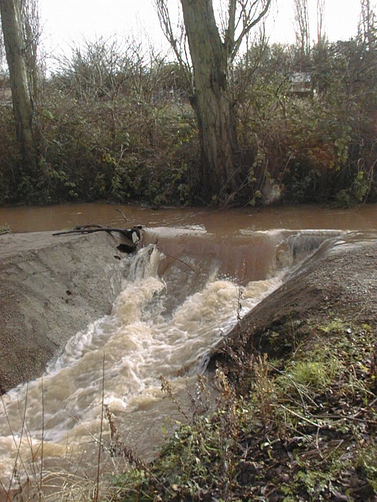
This pipe forms a weir to regulate the water flowing from the Sherbourne into the old course of the river and thereby maintain the flow to the Spon End Mill. It is probably set too high and could use some thought as to its correct level and perhaps be opened up. In 2017 this is completely hidden behind a soil embankment and thick overgrowth.
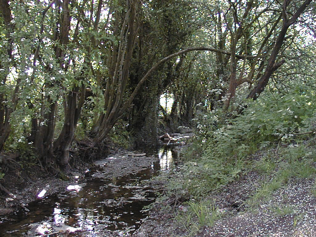
The original river bed is rich in tree species showing hundreds of years of development. It is sometimes short of water.
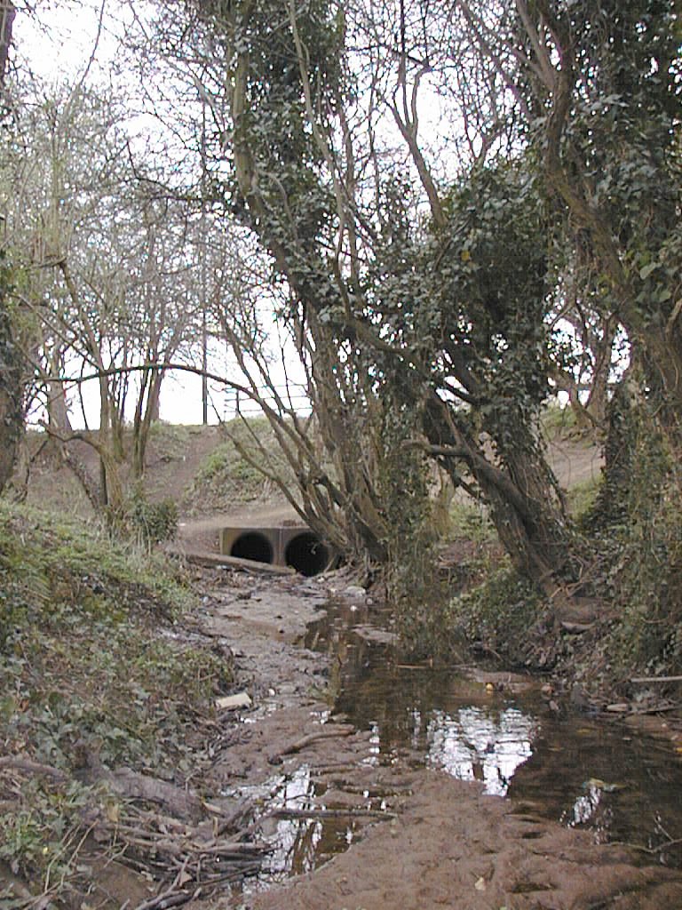
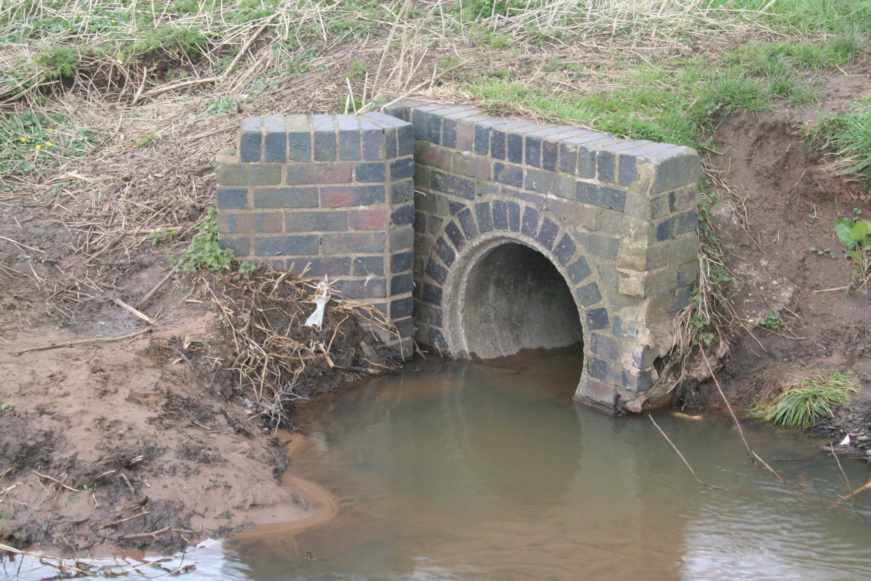
This section of the river bed terminates with two 36 inch concrete pipes under Four Pounds Avenue which were built around 1938.
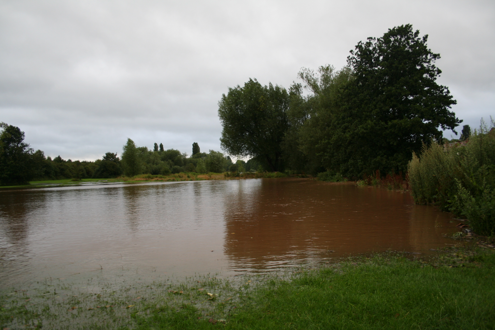
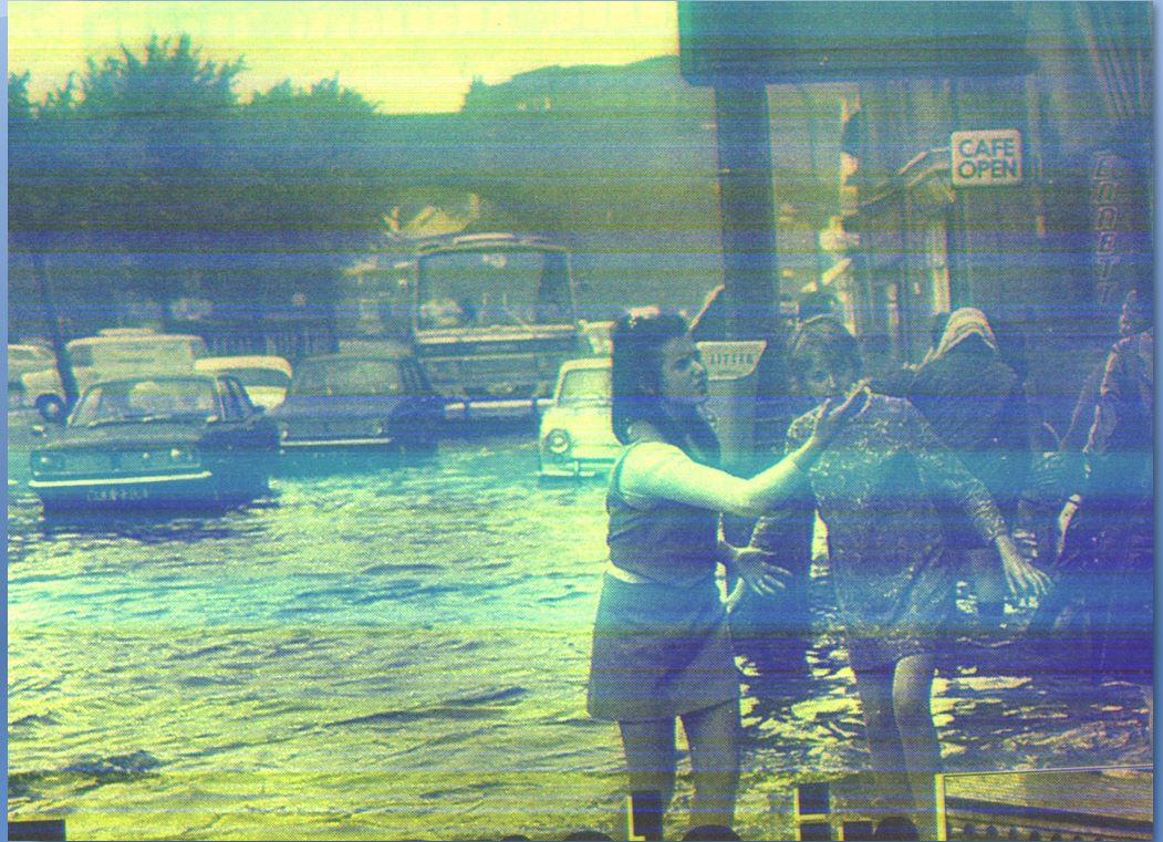
The river flooded in 2014. The name Lake View is a fantasy. Many boreholes were drilled in the 1960's and the ground is extremely porous and could not sustain a lake and almost certainly never has. This one disappeared in two days.

The next day large parts of Tewkesbury diasappeared under water.
Looking up to Four Pounds Avenue. The walker is climbing the side of a mound of rubble dumped there in 1940. he is climbing over 20,000 tons of the City of Coventry blitz debris. One day the archeologist should have some fun there. The semi-circle shape of the mound of rubble is clearly shown on the next picture.
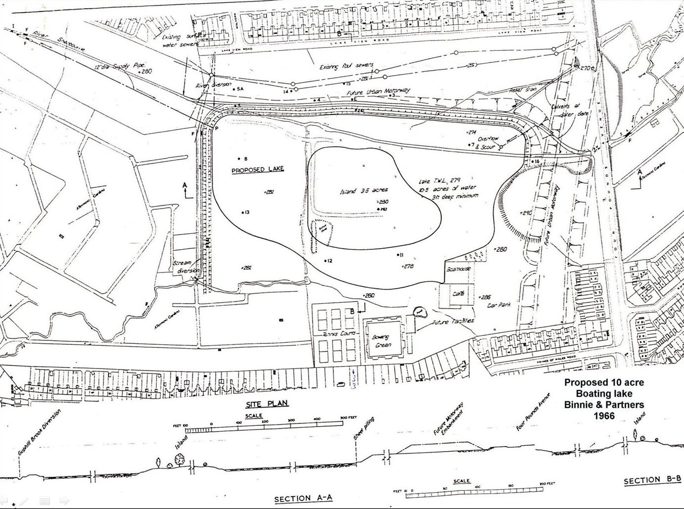
This is the abomination that Coventry City Council commissioned from Binnie & partners in 1966. It shows the park disappearing under a huge concrete lake with a boating dock, tennis courts, cafe, bowling green and an access road and car park. The Guphill Brook has already been diverted and canalised in preparation for this. On the right is a rebuilt Four Pounds Avenue rising thirty feet in the air to cross above the houses in Chapelfields and to go half a mile in the air to an interchange on Hearsall Common. To the north of this map are the words "future urban motorway". Their intention was to take a major highway from the junction of Holyhead Road and Four Pounds Avenue and sweep it through the park to Allesley. I am told the road scheme stretched three miles to the east as far as Wyken.We should all give thanks daily that the money was never found to fund this monstrosity.
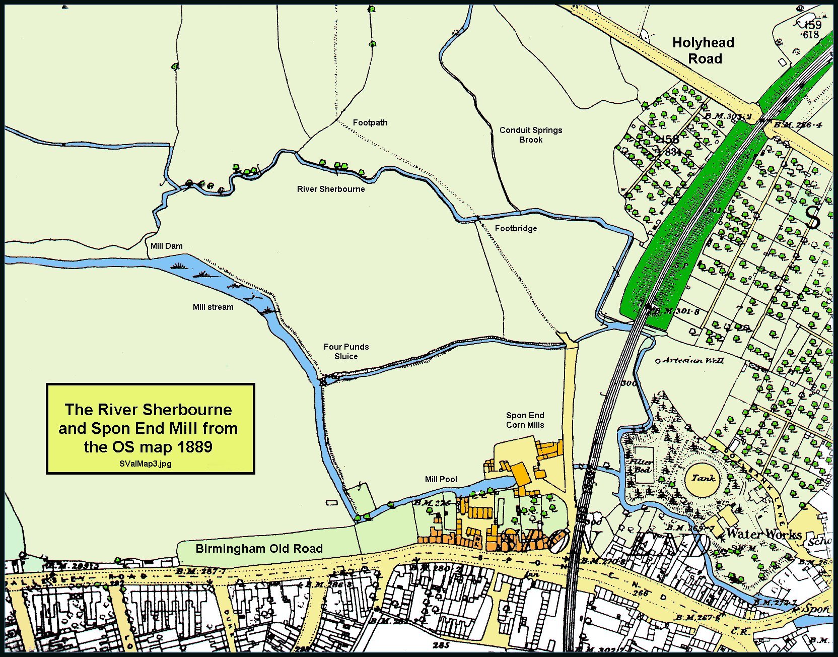
We have now crossed Four Pounds Avenue and entered the Sherbourne Valley Allotments which lead to Spon End. This OS map dates from around 1891 and shows and Conduit Springs Brook which ran from St. Catherine's Well to the north into the River Serbourne.
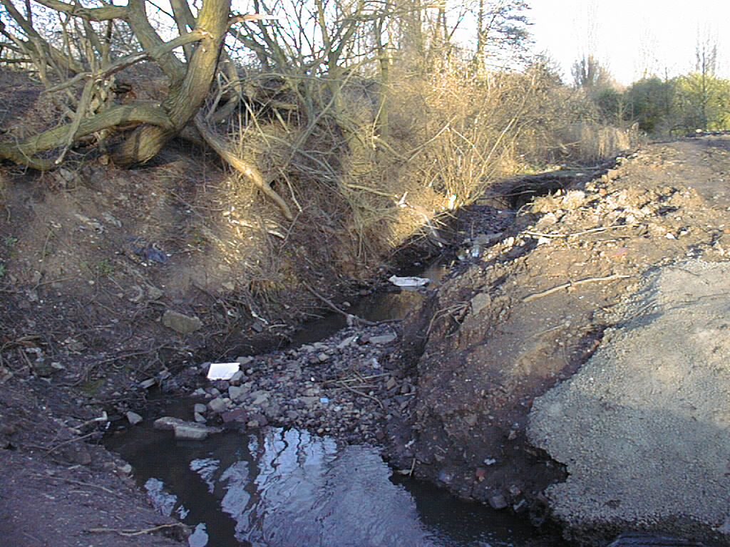
Just south of Four Pounds Avenue the mill stream decided to make itself a new stream to rejoin the original bed about ten feet below and 100 yards to the north. The City commissioned this dam around 1998 to restore the flow to the mill stream. Soon after completion there was a flood and a garden on the new Rivermead Estate was flooded. Men came out and removed a couple of railway sleepers from the dam. Shortly after that another flood caused problems in Pavillion Close and the railway sleepers went back in. I was, at the time, chair of the local Environment Committee for the City Council and it felt like the Wild West gang wars. The area is now thoroughly overgrown and almost inaccessible. I do not know how many sleepers are in place.
Around 1972 about 15,000 tons of rubbish were dumped in the area immdiately north east of Four Pounds Avenue. I saw numerous 50 gallon barrels dumped there containing who-knows-what filth which is slowly leaching into the water table. This was done by the City Council but some of the dumping was surreptitious fly-tipping. Some of it can be seen here on the right. The whole is about 20 feet deep and covers an area of around 1000 square yards. In modern money that is about 15,000 cubic metres at just under a tonne per cubic metre.
In 1954 I sat here behind the Alvis Cricket Pavillion when Four Pounds Avenue was still a footpath. It was a warm and deathly quiet summer afternoon and there was a gentle plonk and an otter swam slowly across the pool.
The price of freedom is eternal vigilance. So, it would appear, is the price of good governance.
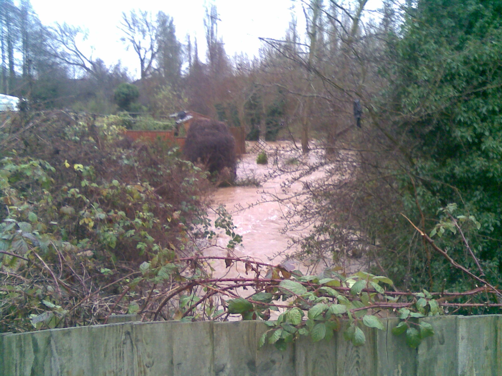
This is the old course of the Sherbourne in flood behind Pavillion Close in 2014. Five tons of water per second were on their way to help flood Tewkesbury the following day.
St Catherine's Well can be found in Lammas Road just off the Holyhead Road. For some time in the eighteenth century it was used as a source of water for the city and a tale was put about that it was a gateway to Hell to keep people away from it. It may have had a small flow into the Sherbourne at some time but all that remains is a dirty drain from the nearby car park.
This outlet was built by The Alvis Company around 1955 and has always deposited muck in the river. It was once on the course of the stream from St. Catherine's Well called Conduit Springs Brook. This is on the footpath between Spon End and the Holyhead Road which used to be called The Chain Gardens after the nearby Renold and Coventry Chain works.
The Four Pounds Sluice is the only remaining part of the Spon End Mill. It would have regulated the height of the water for the mill wheel. The name Four Pounds probably derives from the days when Spon End held Coventry to ransome by charging a toll for the passage of animals into the city. The nearby Spon End was the main road from Coventry to Lichfield, our joint diocesan partner, and a main road into the city. The Four Pounds would have been fields where the animals were held for counting and payment of the tolls. The sluice is now in the Sherbourne Valley Allotments and the Rivermead Estate forms the backdrop.
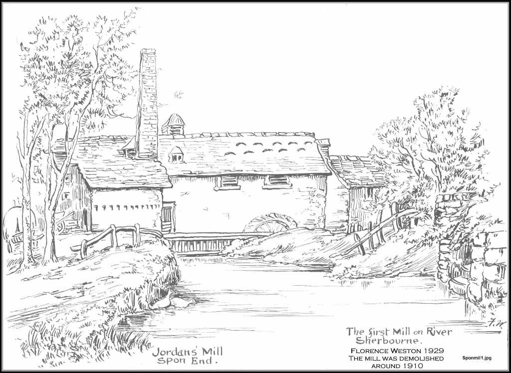
This is the only picture of the Spon End Mill I have ever seen. This is a pen and ink drawing on a Post Card made around 1920 by Florence Weston so it must be a copy of something else as the mill was demolished in 1906 to build the Coventry Chain Company's new factory. This view is looking east and should have the arches behind as this is clearly a late view with a chimney to power a steam engine and therefore probably after the railway was built in 1848. Good artistic licence.
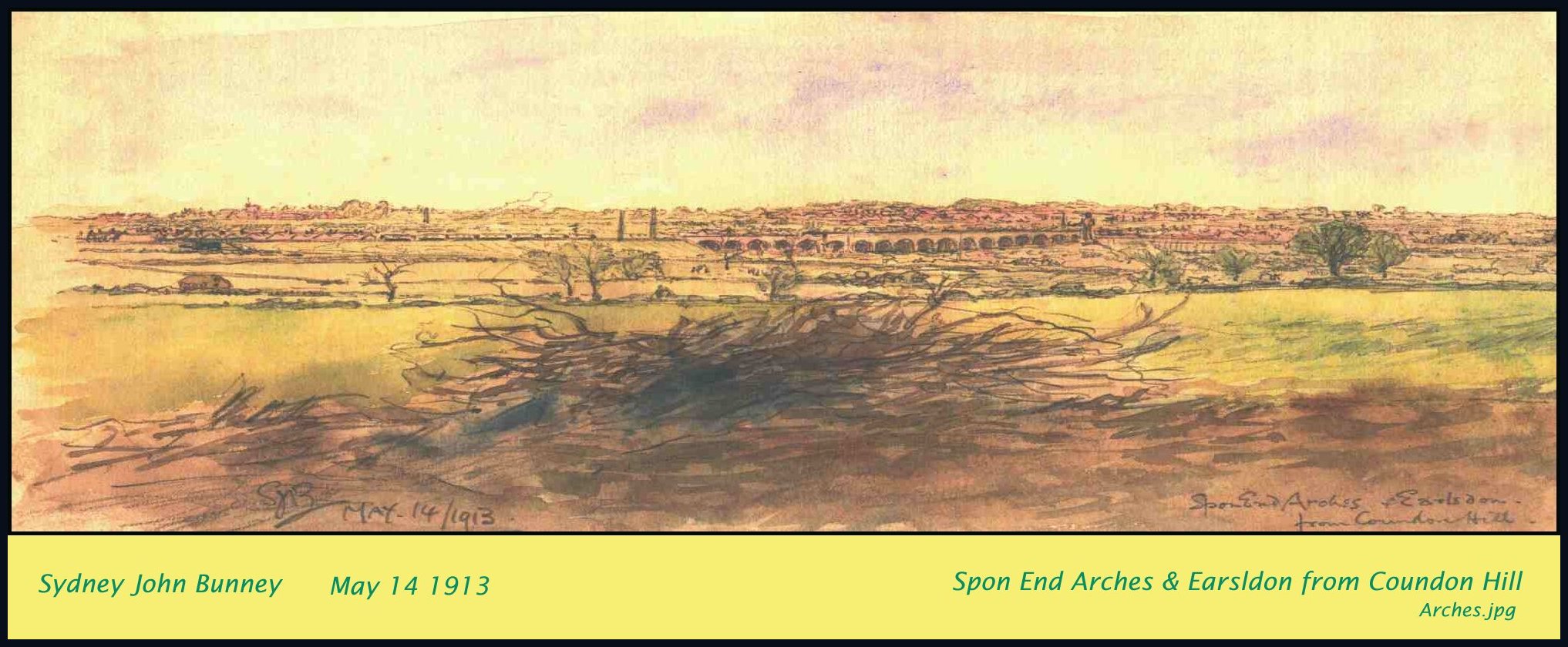
The whole of the Shebourne Valley in Spon End is shown here by Sydney Bunney in a view no longer available. A steam train can be seen on the railway with the smoke blowing to the right. Just behind that are the twin chimneys of the Spon End Waterworks. On the left, on the railway embankment is a black mark which is probably the bridge over the Holyhead Road known for over half a century as The Alvis Bridge. The second Alvis factory was built dead center in this picture around 1938. The small building on the left is probably St. Catherine's Well
The arches were a very early railway construction around 1848 and about nine years later around twelve of them fell down. Arches have a very stable form of constuction and their destruction is rare. There was a storm on the night in question and I think the River Sherbourne must have undercut the foundations of one of the piers and brought the whole lot down like dominoes. Many of the arches on the left of this picture have been embanked by dumping spoil under them - a common practice. The rebuilt arches were made with blue-bricks instead of the original local sandstone which had, perhaps, not been the best material to use and the juction of old and new bridge is quite clear. The numerous remaining sandstone piers appear in fine condition after another 160 years.
At the far end of the arches in this picture can be seen a structure that looks like a giant man. It stands near to the arches but is three times as high. That would make it 150 feet high. I believe that is the original Angel of The North and the Geordies nicked it. I can think of no other explanation.
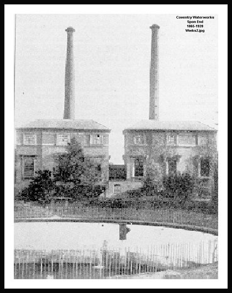
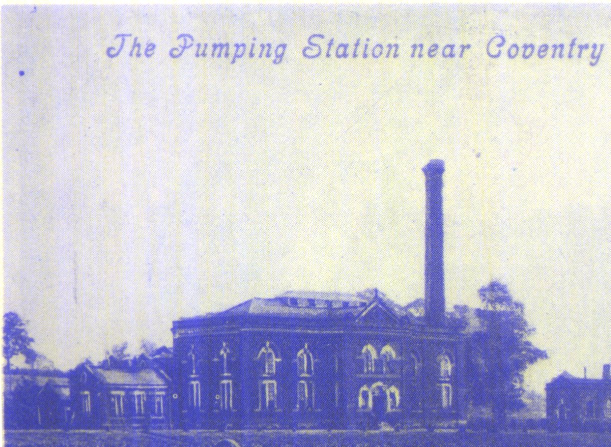
The Spon End Waterworks were built in 1847 to replace the conduits used for 200 years at Swanswell. The large beam engines were decommissioned around 1936 but water is still pumped from the site by small pumps in sheds and makes a useful contribution to the flow of the River Sherbourne. The photograph shows the two pump houses and a large settling tank. This was filled in around 1990 and now forms a park in Northumberland Road.
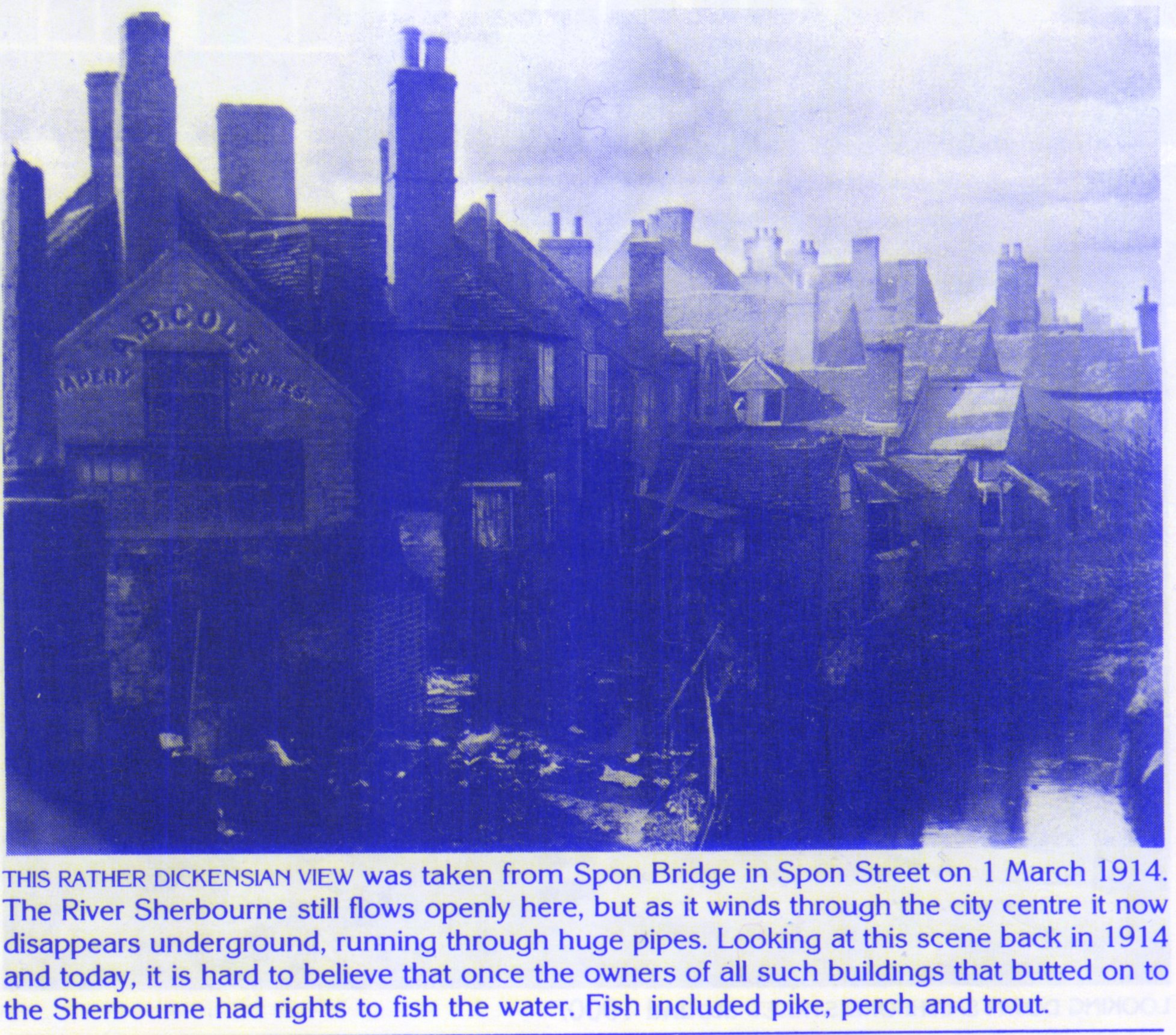
This delightful view of the jumble of houses in medieval Spon End is still largely alive although not unchanged. The waterworks is off to the right here and the site was probably chosen because of the nature of the water table which has continued to provide water through nearly two hundred years. In 1914 the householders had rights to fish pike, perch and trout.
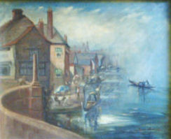
This is a copy of a painting by Van Art of Coventry. The original is in the Railway Club at the far end of this row of buildings. It shows a fantasy of Spon Gate bridge with gondolas. The building in the forground has foundations dating to the tenth century.
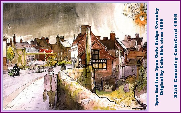
Another view of Spon Bridge in classic 1950's format. The man carrying his shopping bag to Sainbury's, the motorbike and sidecar and the car transporter taking TR3's back to the factory at Canley. The view has now added only trees.
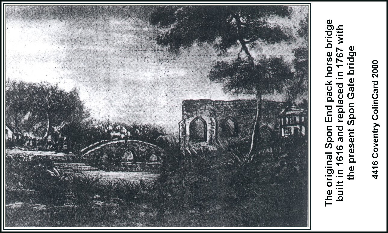
The crossing of the river was a major hazard for centuries and the chapel of St.Christopher and St.James on the right was a wayfarers' resting place dating to around the tenth century. St.Christopher is the patron saint of travellers and St. James the patron of visitors. The pack horse bridge was built in 1616 and replaced with the present bridge in 1767.
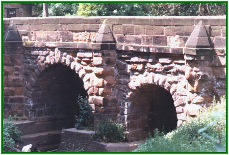
This bridge was built the year after the American Revolution. It was built with sandstones from the Spon Gate near to St. John's church further down Spon Street. The carts had developed until they were too big to get through the gates so the gates were nearly all demolished. Stones were much too useful and expensive to be dumped so they were recycled. The bridge has survived 238 years and has carried busses and trams and lots of traffic up until around 1968.
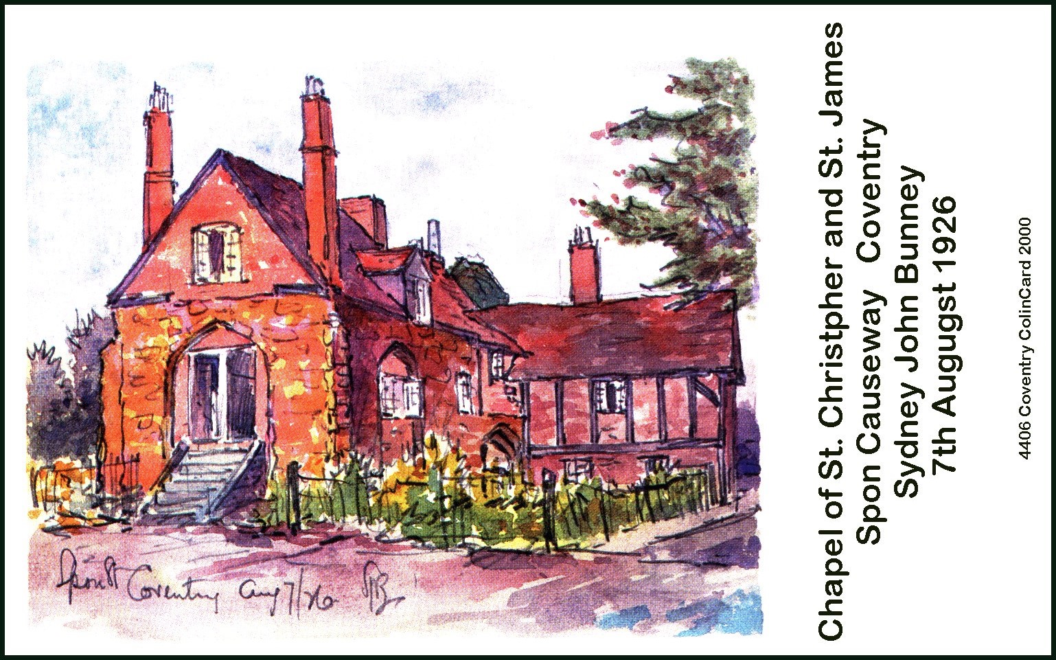
This was how Sydney Bunney saw the chapel around 1926. The building fell into disuse after the second world war and was largely demolished in the 1960's. Its ruins remain in place. The foundations are around 1000 years old.
This is a painting of Spon End by Cox. The fine row of medieval cottages still largely survives but the foundations are daily shaken by a four lane major highway into Coventry. The village owed its existence to the River Sherbourne.
This was taken in Spon End around 1965 and was the last time the street flooded. The famous Coventry Sewer which featured in Micheal Caine's The Italian Job now takes a lot of flood water from this part of Coventry.
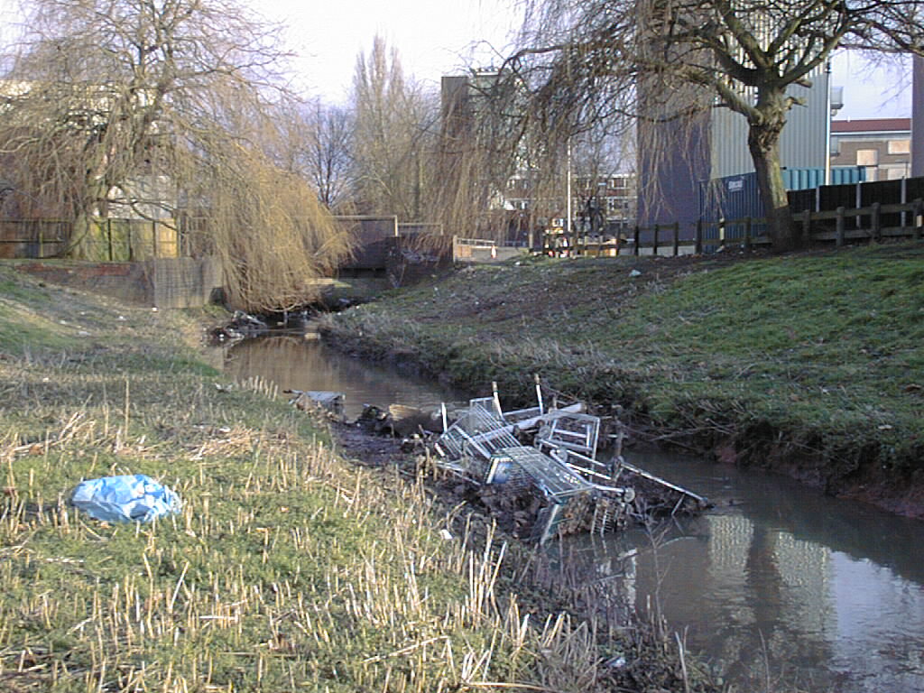
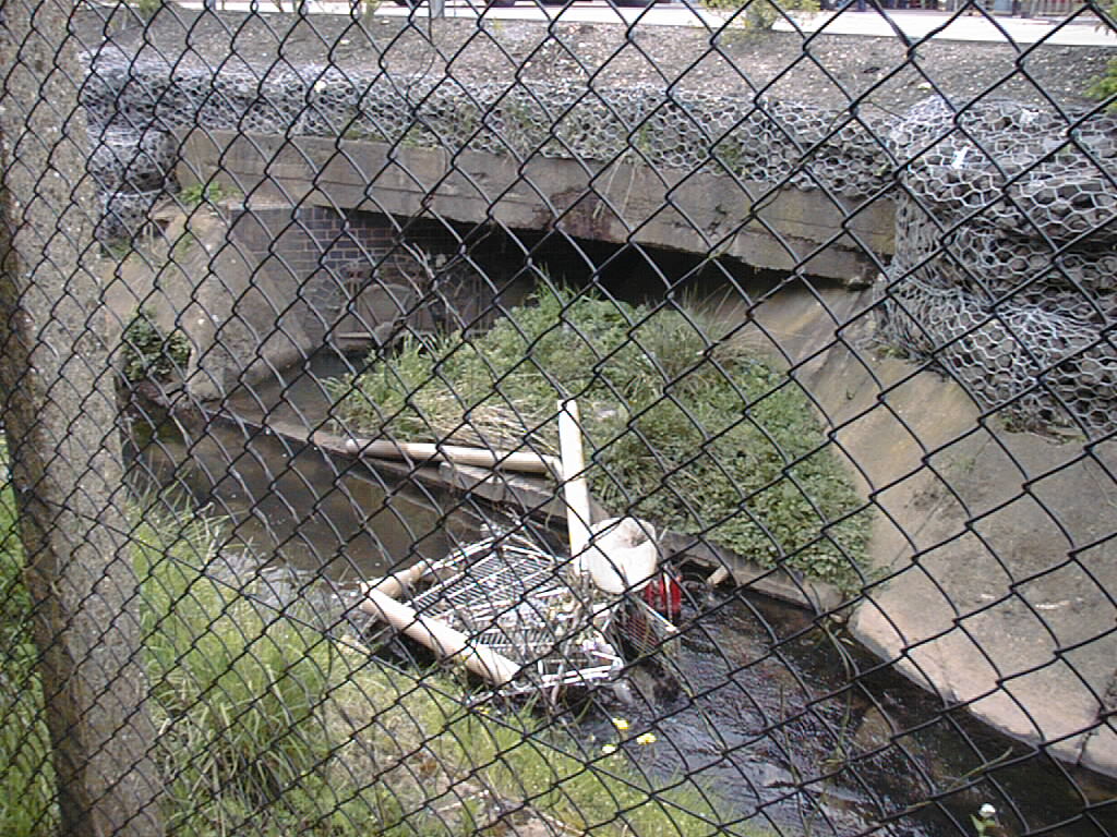
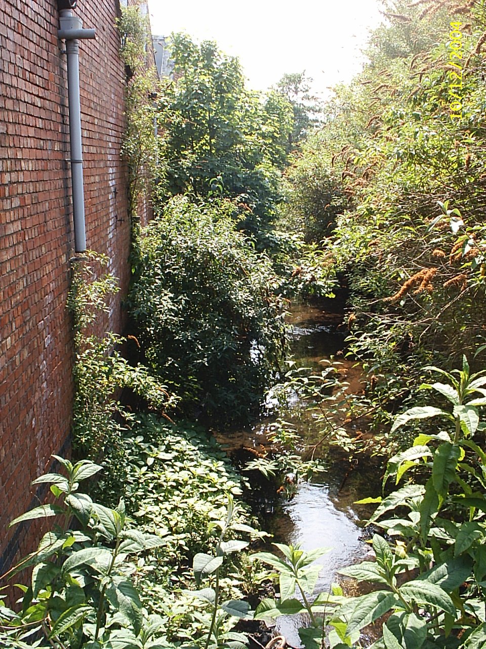
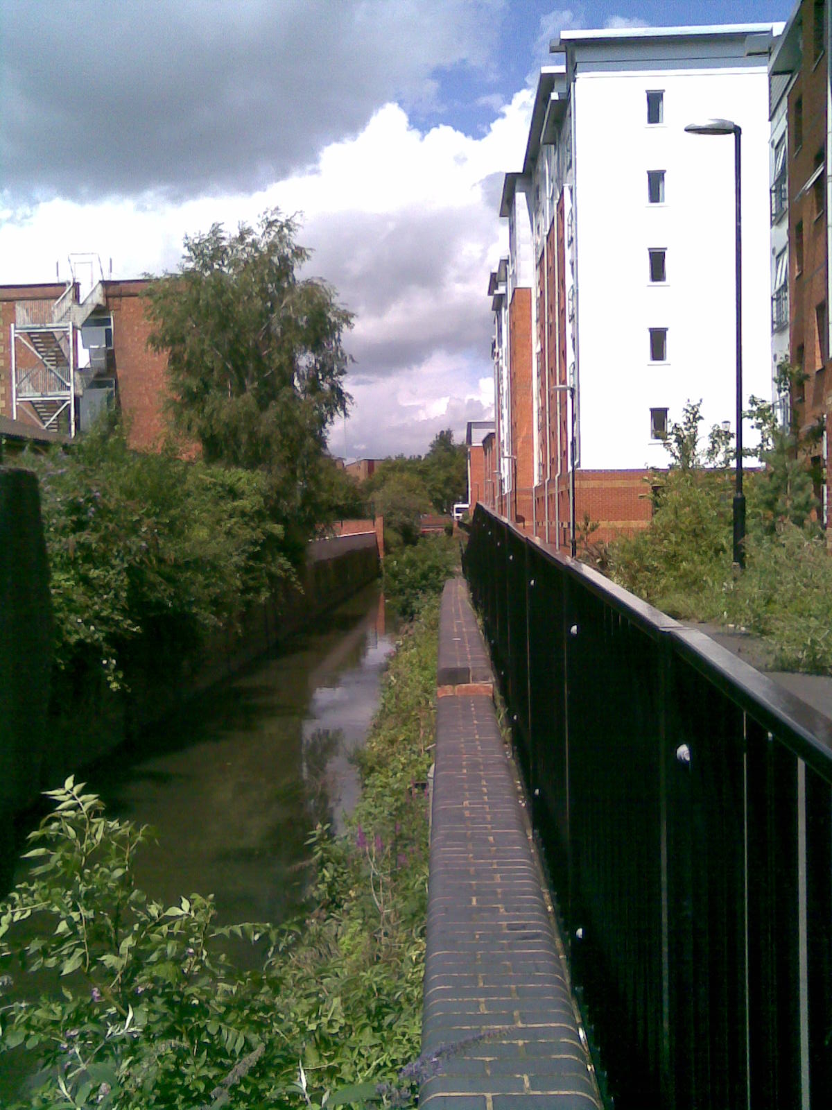
The river now heads into The Spon End Estate. This is quite small but is one of the most deprived areas of Britain. It misses the general view because it is a very small part of a very large and wealthy Ward and the statistics never reveal it. The river does. One day we took 68 trolley out of this part of the river in two hours.
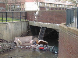
We solved this problem very largely by getting the local wardens to get the trolleys out of the river and store them in a lock-up under one of the blocks of flats for later disposal. In 2016 the bankside undergrowth is so thick that no one can get near the river and it is much cleaner.
Crow Mill was near here in Crow Lane and in the thirteenth century The Leet ordered its owner to clean the river. The problem of rubbish in the Sherbourne is not new.
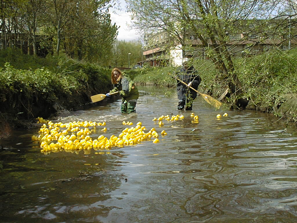
We tried to engender some respect for the river by using it. Even though the river was in flood we had to paddle the ducks along - and my duck naturally won! These two brave ladies paddled about two hundred yards along the river coaxing the ducks. I went in with my waders to clear the worst of the rubbish hidden on the bed of the river but quickly gave up. Some of it was lethal.
One day I received a plaintive phone call asking me to help. There had been a flash flood the night before and around 24 Coy Carp had been washed downstream until stopped by the grid which stops rubbish getting under the city. We called the RSPCA and they arrived quite soon but not before a man from The Black County had arrived with a van intent on catching them. We won. We did not ask where these illegl carp had come from.
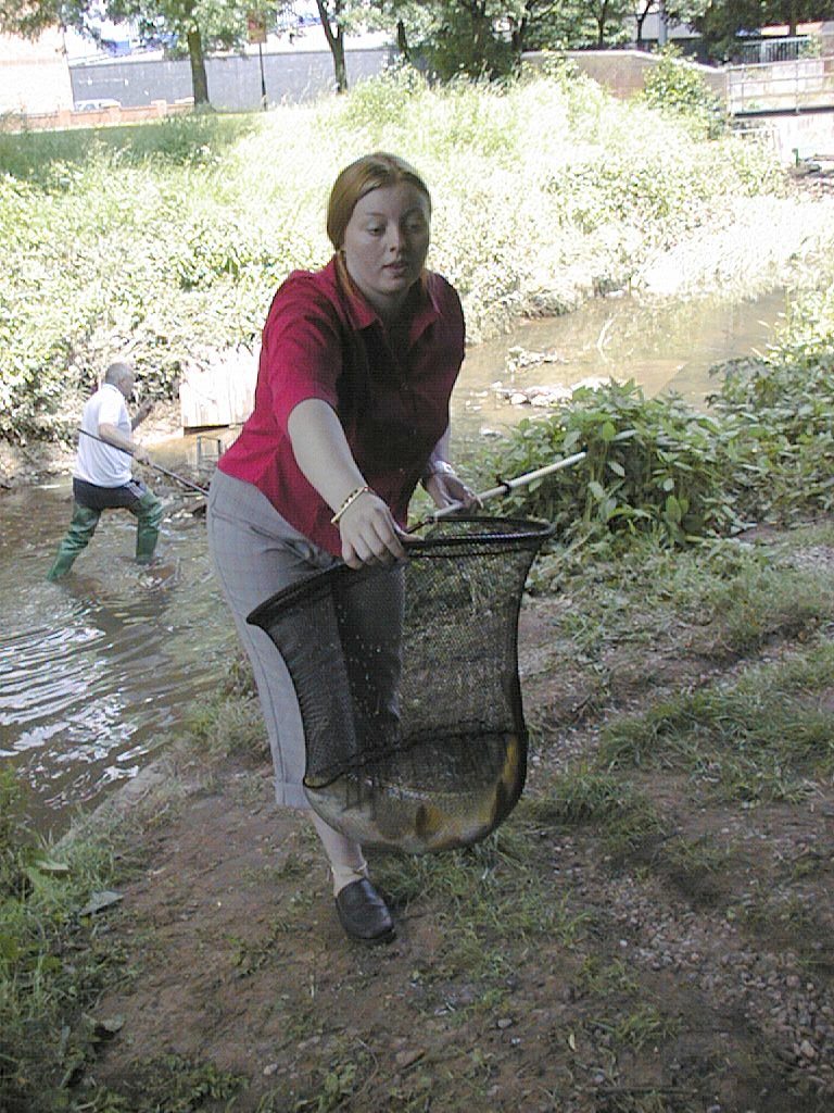
One of the carp about 27 inches long. My attempts to find the source of these carp led to my quest to map the whole of the Sherbourne valley.
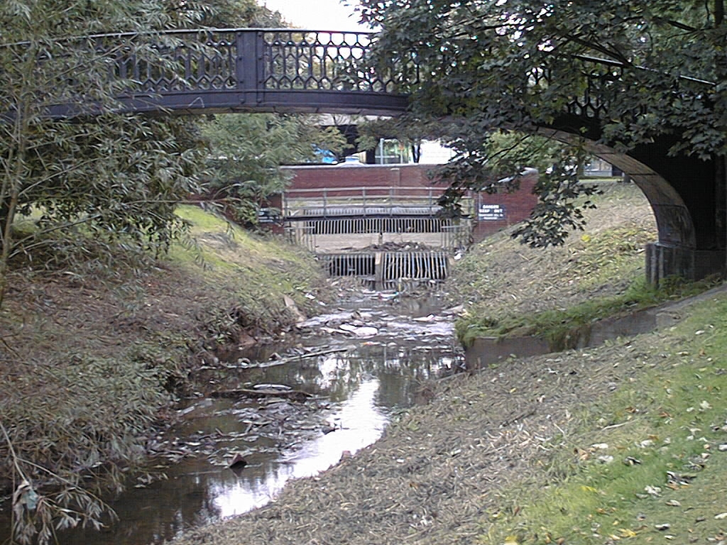
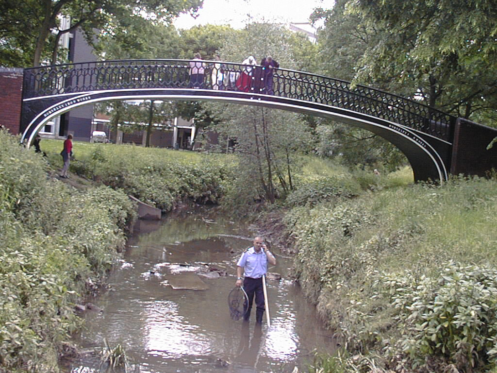
The grid in the background marks where the river disappears under The Coventry Ring Road. The city removes around two tons of rubbish from this grid every week, much of it Crack Willow branches. The bridge came from the Wyken Arm of The Oxford Canal and was removed when the M6 was built across its path. The local people love it. It is Cast Iron and Made in England.
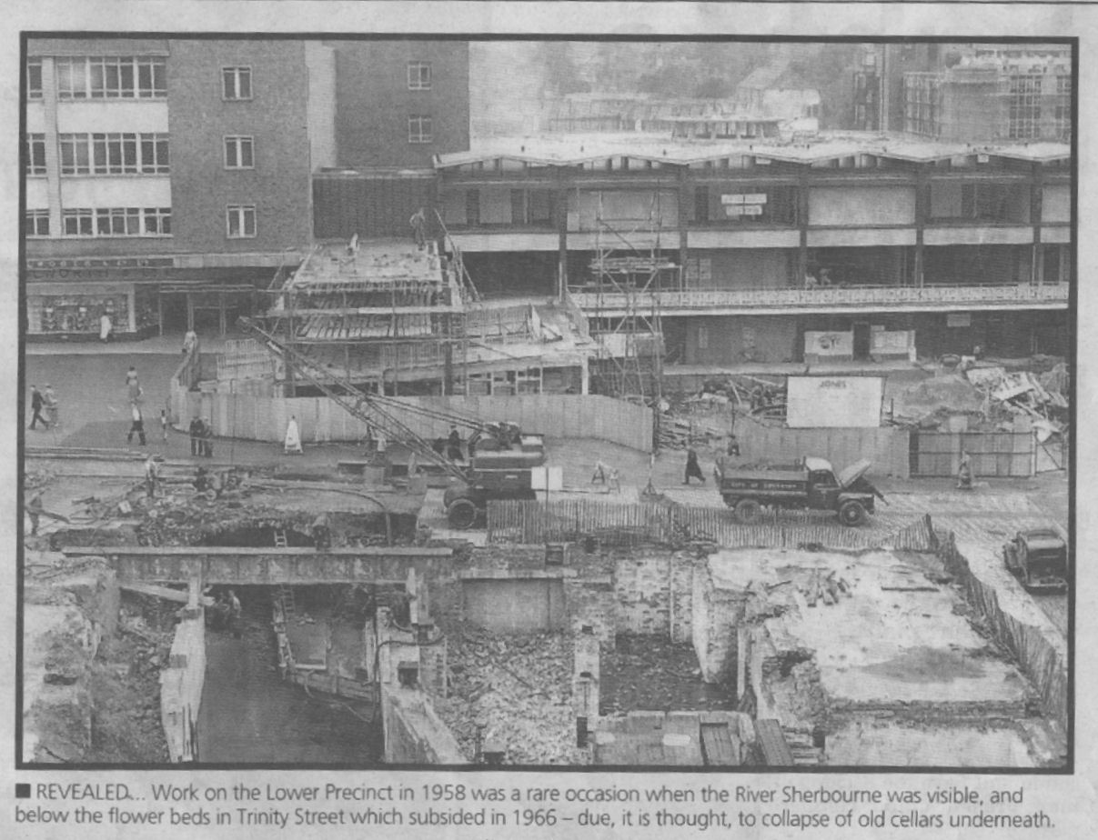
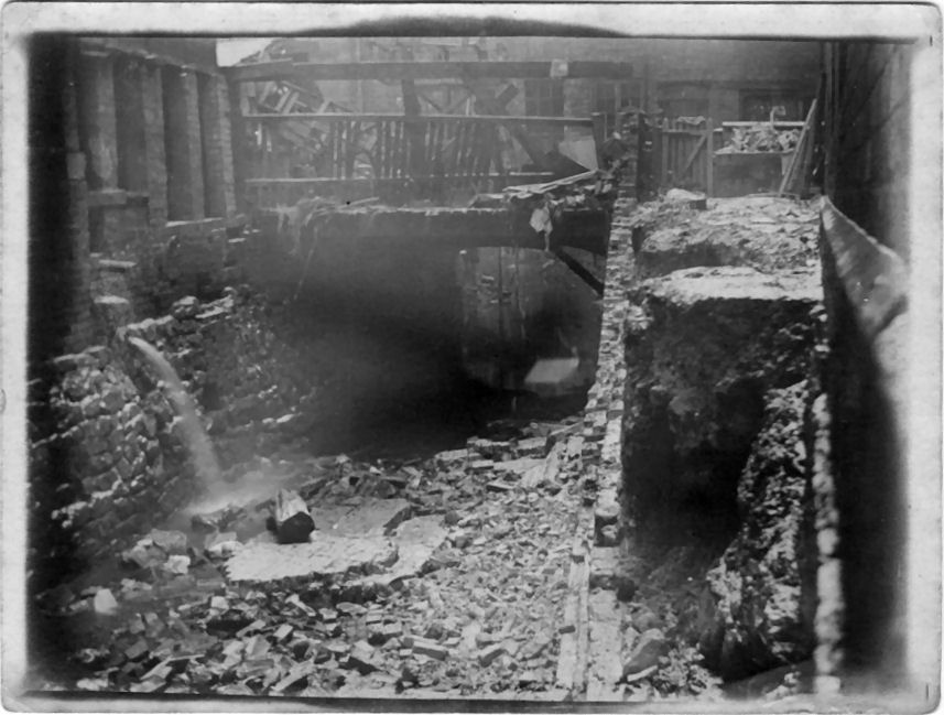
This shows the construction of the Lower Precinct in 1958. The river comes alongside the Woolworth building - now Boots - and crosses the Lower Precinct - then Smithford Street - where the ramp between upper and lower precincts now is.
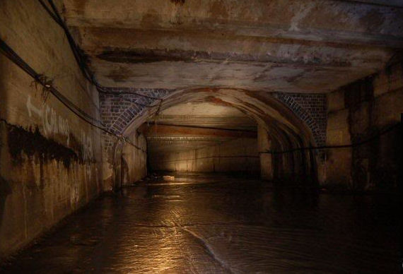
This photograph was taken by some young people who went adventuring through the tunnels around 2000. The arch is the original Ram Bridge in Smithford Street so is directly underneath the picture above.
The river opens up only once in the city centre in Palmer Lane behind The Burges. Palmer meant Pilgrim and this was the route to St Mary's Priory, founded by Godiva and Leofric in 1034. The building on the right was an inn and had an outside toilet called a Guardrobe which discharged directly into the river. Many pilgim badges were found in the bed of the river here.
The Burges is a corruption of St. George's Bridges of which there were two. One traversed the River Sherbourne and the other Radford Brook which joined the river here. Now the Radford Brook joins the River near to the Belgrade Theatre in Corporation street.
This picture of The Bridges was due to Dr. Nathaniel Troughton
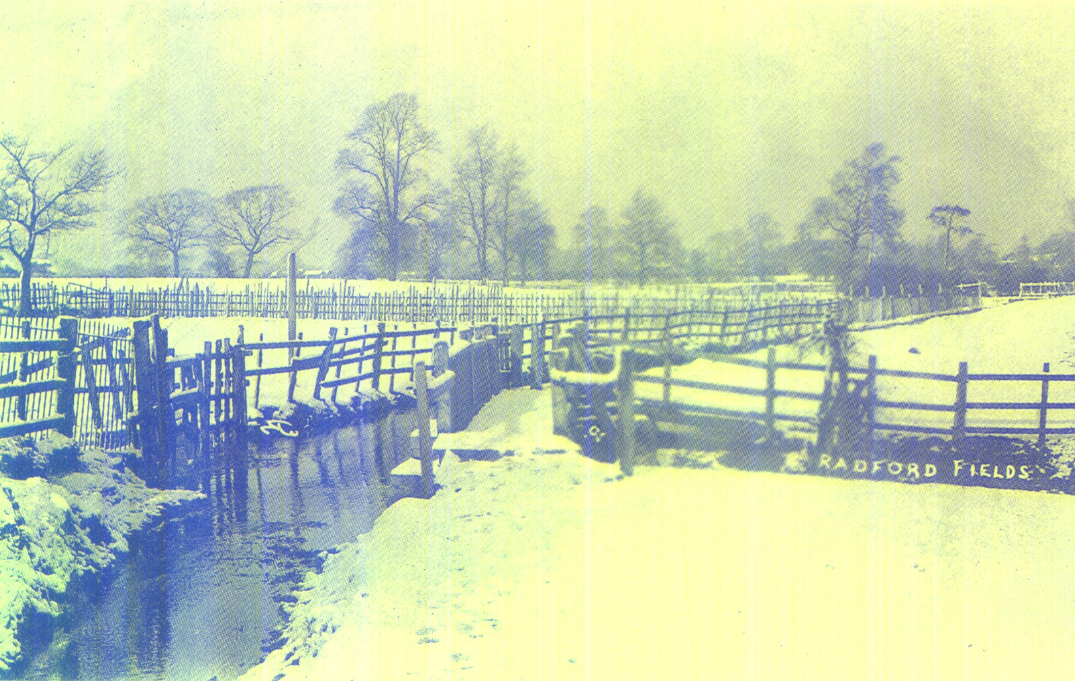
This is a Post Card and is the only picture I have ever seen of Radford Brook. Much of it was still visible as late as 1972 but the last major parts to be culverted were pleasant meanders in the field north of Naul's Mill Park and a lovely waterfall next to the old Naul's Mill building in Abbotts Lane.
There is a shop in Radford Road with an inspection cover under which the brook runs and it used to be visible behind The Savoy and in allotments behind the Radford Pub which is now Aldi.
Nauls Mill Pool is purely ornamental and was built by Coventry City Council around 1910. The original mill pool is on the other side of Middlebourough Road in what is now a small spinney. The pool is, nevertheless, a part of Radford Brook and takes its water from the old mill stream which is piped under the footpath alongside Bablake School. The pool has not been filled between 2006 and 2016 but has been refilled in 2017.
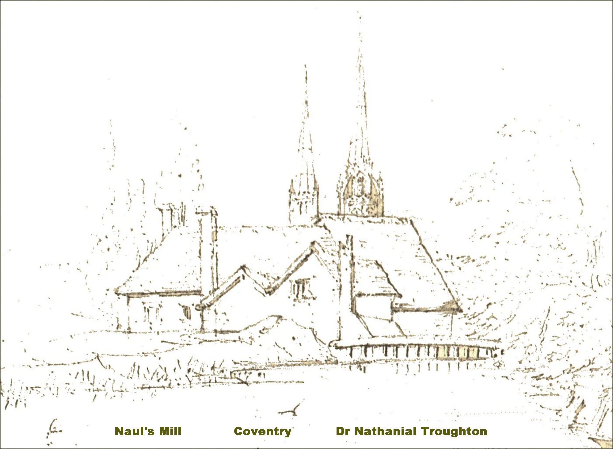
This picture by Dr. Nathaniel Troughton is the only picture I have ever seen of Naul's Mill in Abbotts Lane. It is now a tyre depot. This is the view from what is now Middleborough Road. The mill was the biggest in Coventry, and belonged to the priory and probably fulled cloth . The mill was at one time known as Abbotts Mill.
The River has often flooded and this was in the 1960's and the last time it flooded here.
This flood in 1924 was quite common in the Spon End area. This was Croft Road.
This was Hales Street in 1923 which is now Millennium Place.
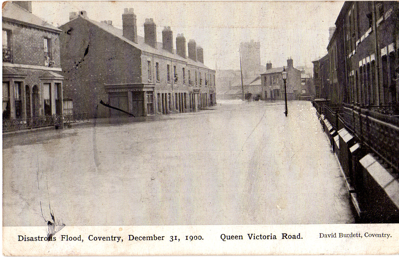
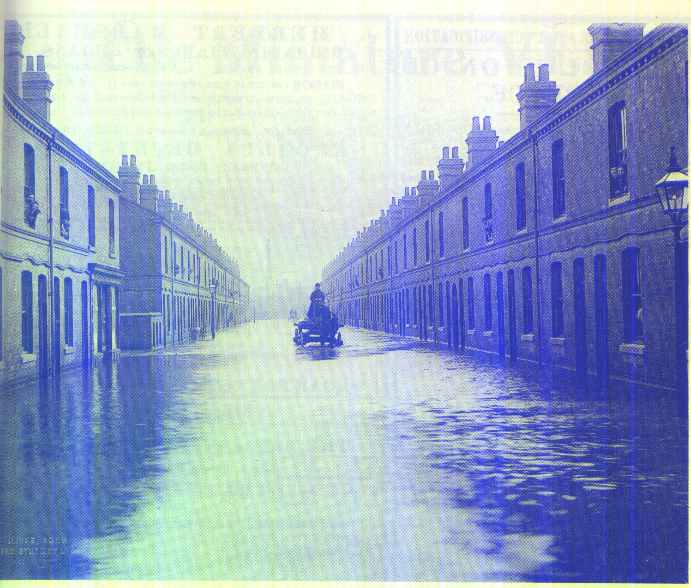
The great flood of 31 January 1900 was possibly the worst of all. This was Queen Victoria Road with St. John's Church in the background.
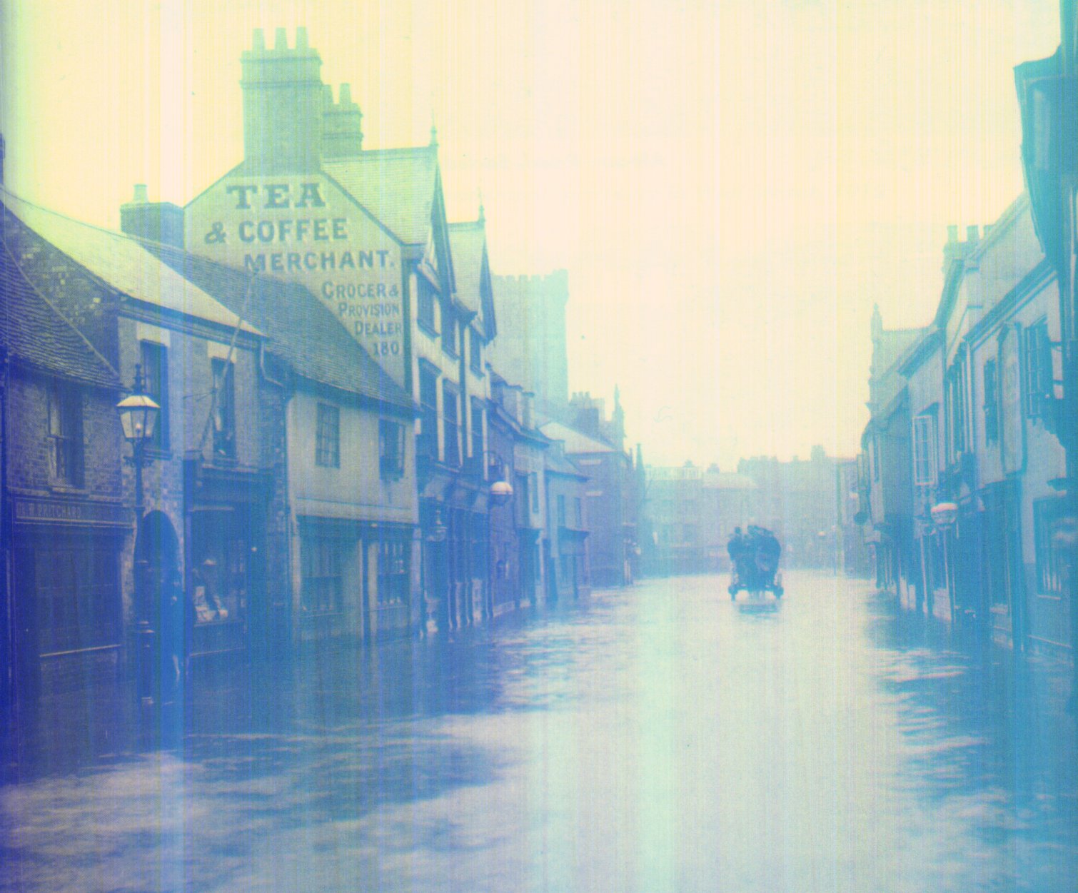
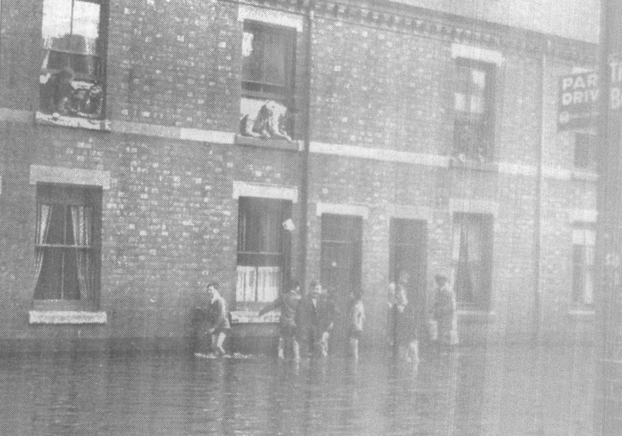
Nearby Spon Street was equally flooded. It was said that one man died whilst asleep in a cellar.
West Orchard suffered extensive damage in the 1900 flood. Courtesy David Fry
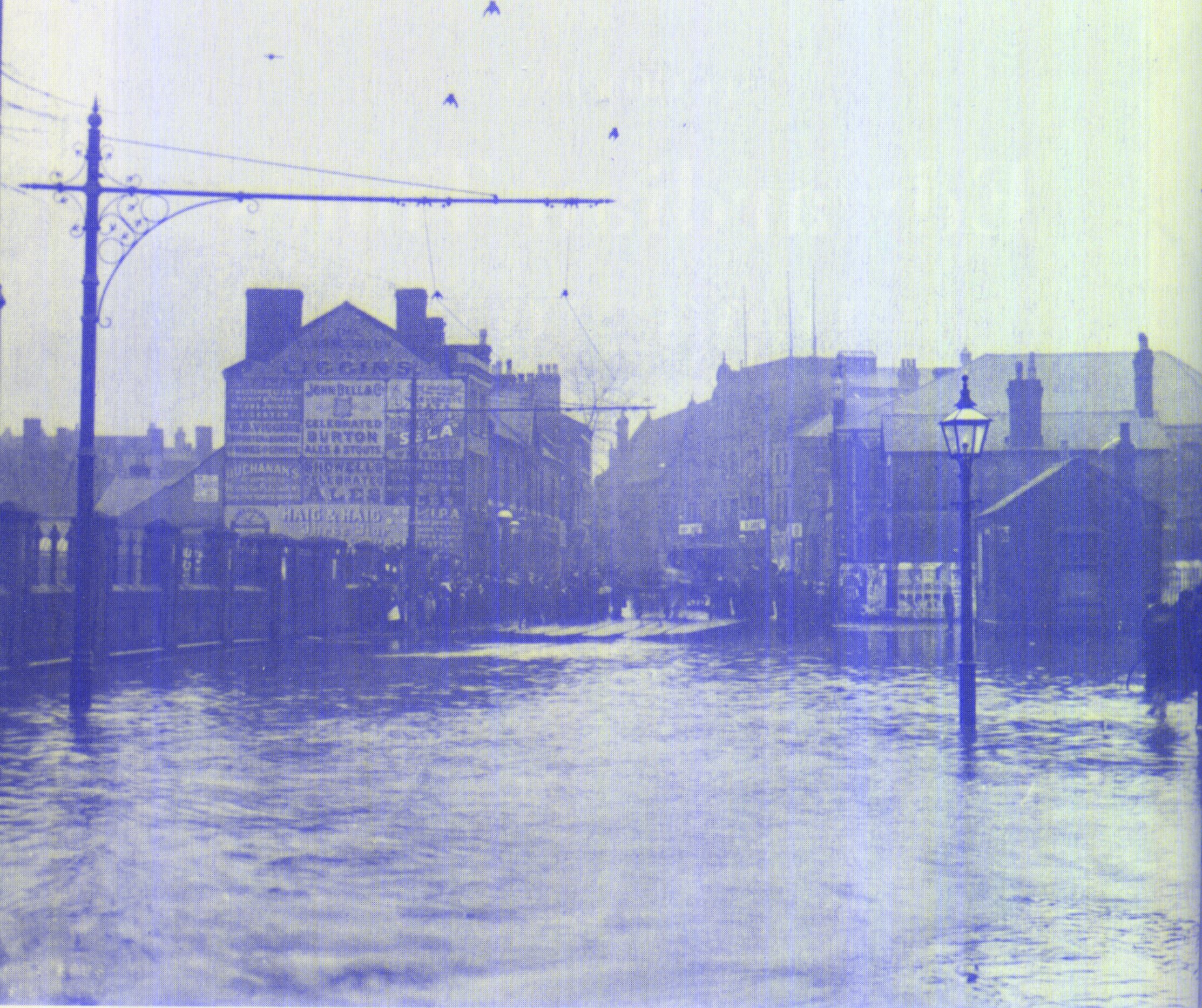
As did Priory Street. Note the Coventry Chain Company which soon after moved to a new building in Spon End. Courtesy David Fry
Godiva Street ran alongside the river and sufferd accordingly in 1900. The tall chimney that can be seen faintly at the end of the street probablybelonged to the Triumph works.
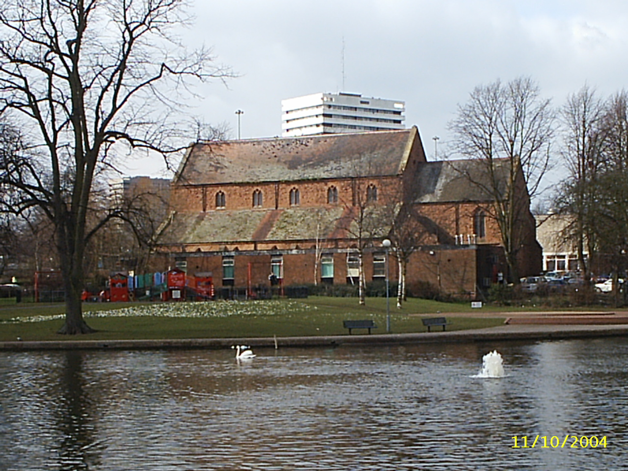
The Swanswell is a corruption of Swine's Well and was once part of Babu Lacu (now Bablake) which in Roman times stretched from St. John's Church to the Swanswell and was in places two metres deep. A causeway took a track across the lake where The Burges now is. The Swanswell is fed by Springfield Brook and the overflow runs into the river under the car park in Pool Meadow. Springfield Brook once ran alongside the Sherbourne and joined the river at Shut Mill.
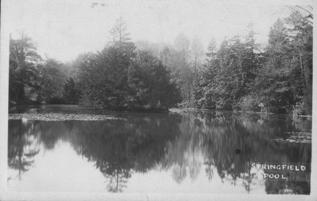
Springfield Pool was on Springfield Farm in Penny Park Lane and the pool was sitied in what is now allotments behind The Scotchill in Radford. It fed The Swanswell via Springfield Brook, (or the River Arthur, or Endemere Brook) and provided Coventry's drinking water for 200 years until 1847 when the Water Works at Spon End were built. Springfield Pool was drained in the 1930's. The Springfield Brook is almost totally culverted.
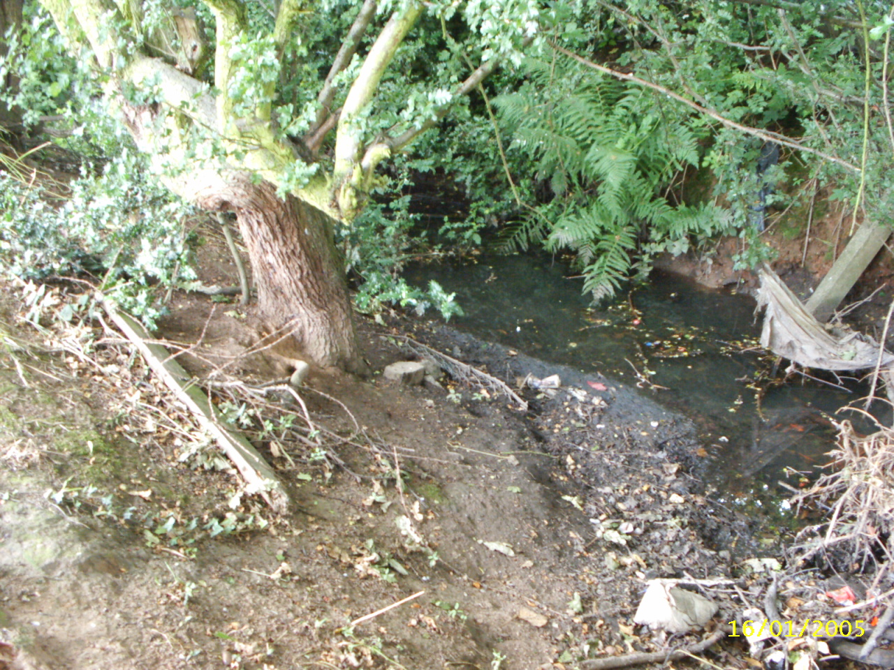
This is the only part of Springfield brook still visible. It is in Sadler Road

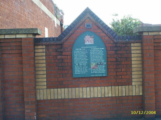
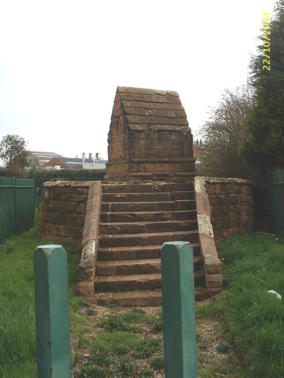
The river is next visible at the site of St. George's Chapel, This plaque stands next to the old Calcott Car building long known as Astleys and now part of Coventry University.
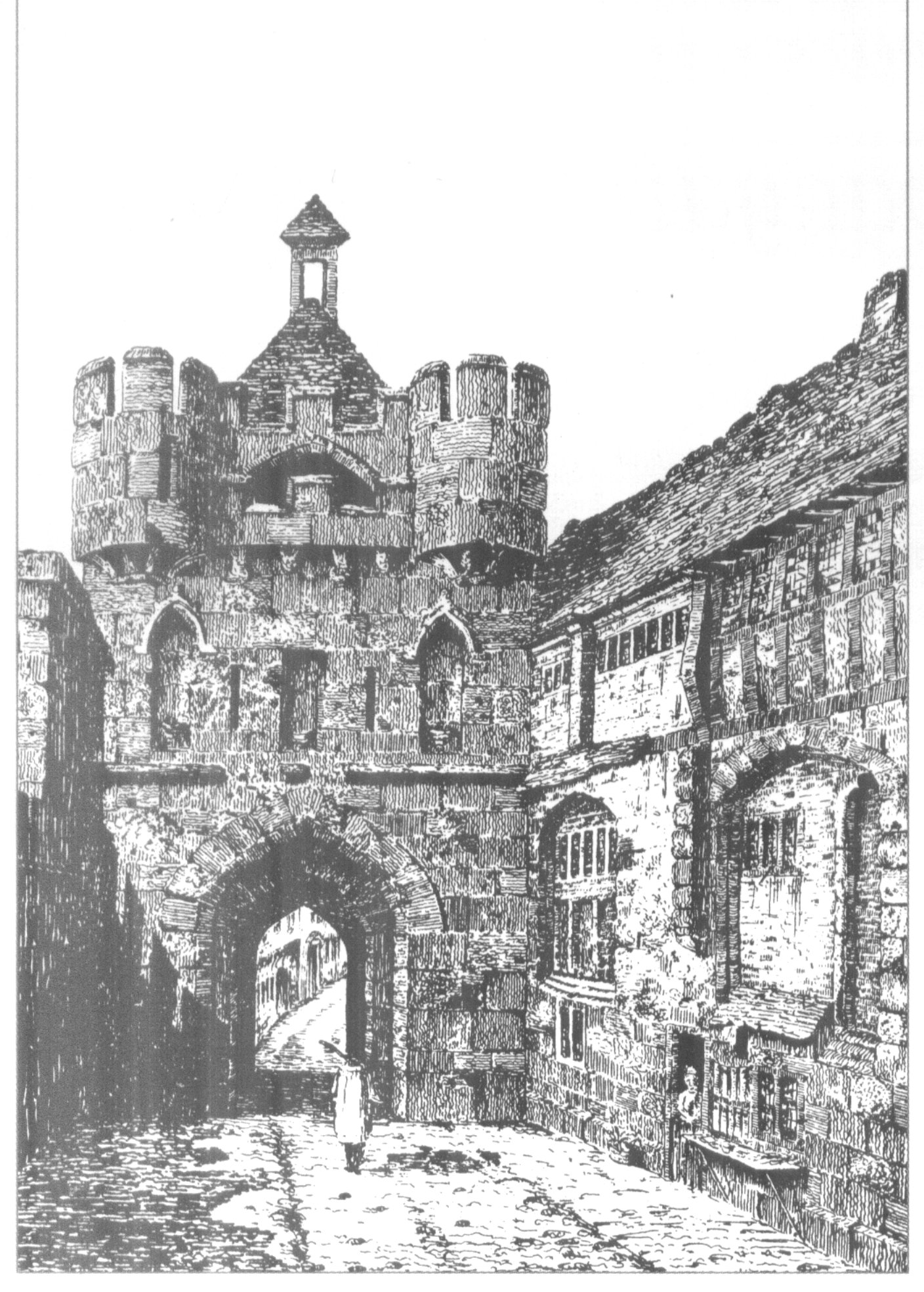
This was St. George's chapel on the right which spanned the river. The Gosford Gate was on the city side of the river.
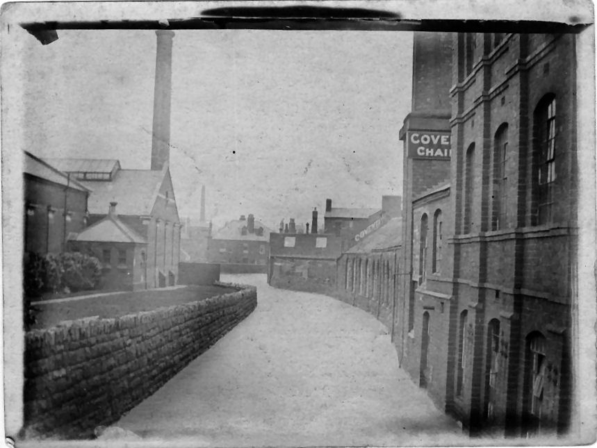
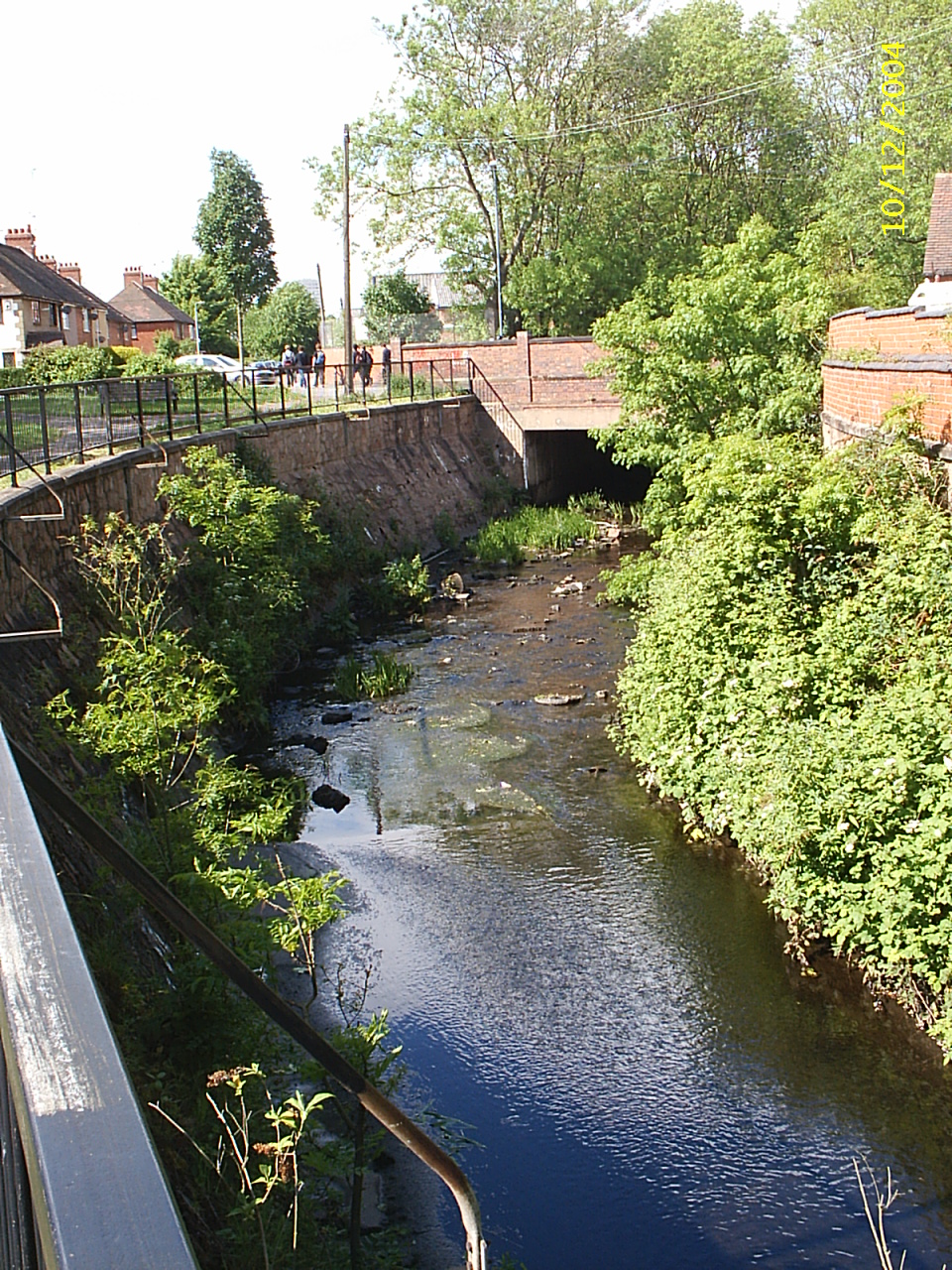
The river runs down the side of the Astleys (formerly Calcott) building and Coventry University has now made a footpath alongside the river down to Gulson Road.
The footpath beside the Calcott building
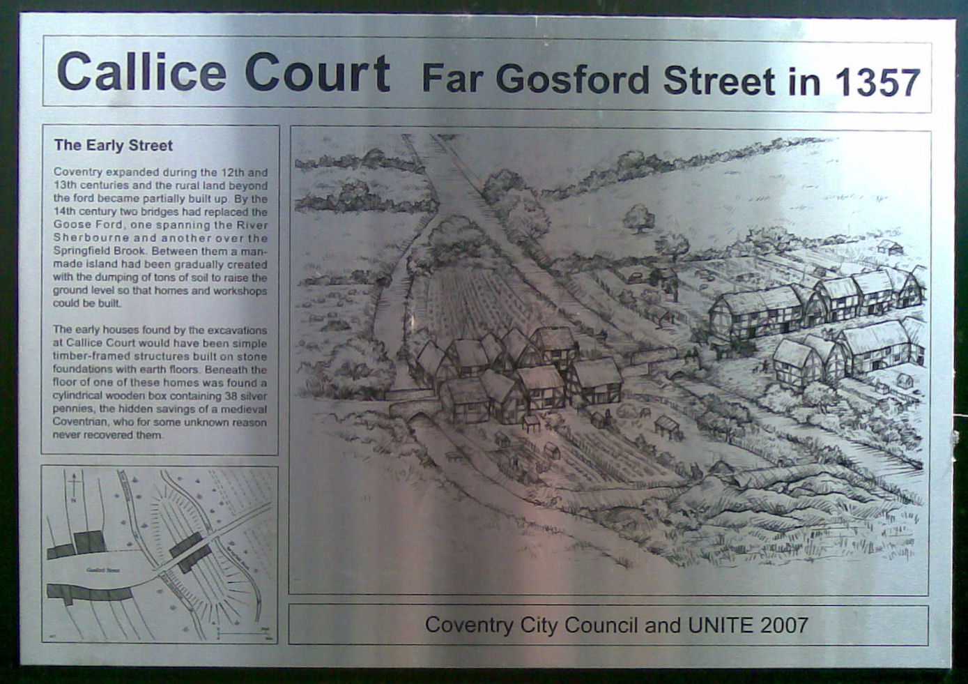
Map of Gosford Street crossing the River Sherbourne in 1357
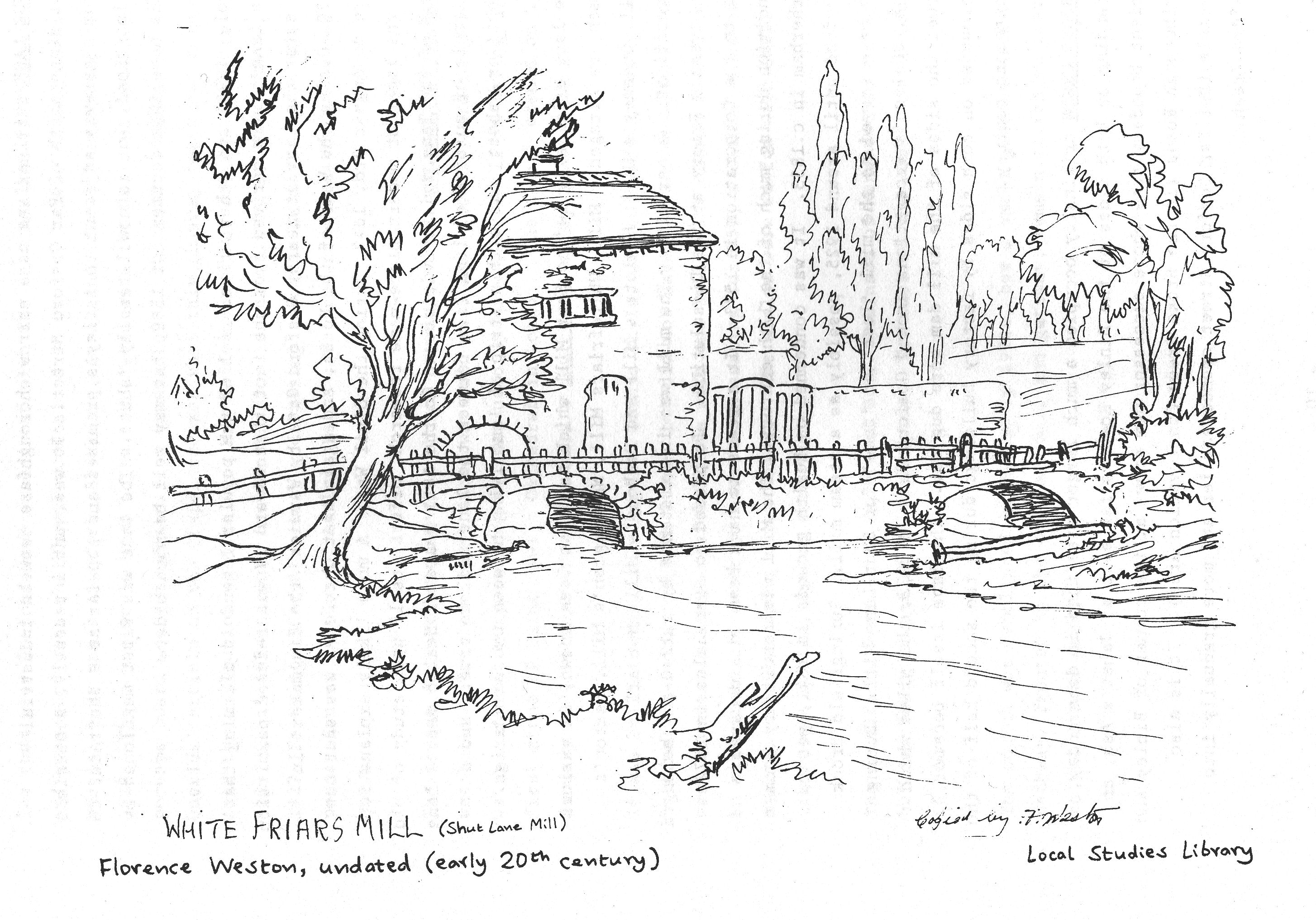
Shut Mill had several names and was in Brick Kiln lane which is now called Gulson Road. Two rivers met there, the second being Springfield Brook. A small stream, Spital Brook, came down from the Gosford Green area.
This view shows the bridge in Acacia Avenue. The high walls were almost certainly used to feed mill water but were also used in 1940 to store water for the blitz.
The river passes behind houses and the walls of The Charterhouse. There is allegedly a Guardrobe in the wall here but I never found it. The monks used to have extensive fish breeding ponds near here.
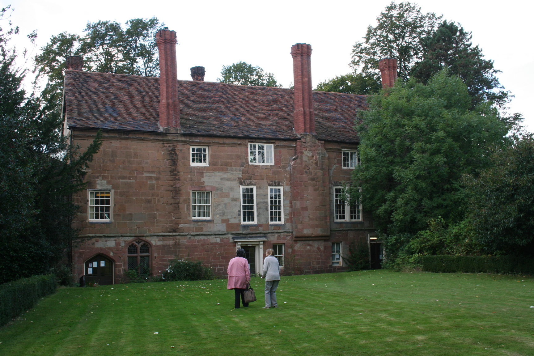
St Anne's Carthusian Priory
The Charterhouse is a Grade II listed building and the best remaining Carthusian Priory in Britain. It was granted a charter by Richard II in 1385.
Just downstream past the Charterhouse is this movable beam which was built during the war to store water for fire fighting. It is a locallylisted monument.
This picture appeared in a book called Journeys with Railways published in the nineteenth century. It shows the new railway from London crossing the Sherbourne valley. The spires of Holy Trinity and St. Micheal's can be seen and, at left, a stage coach on the road to London. This is now the site of a large Ford dealership with the London Road incinerator behind. The bridge now bears the logo 'Ferodo'.
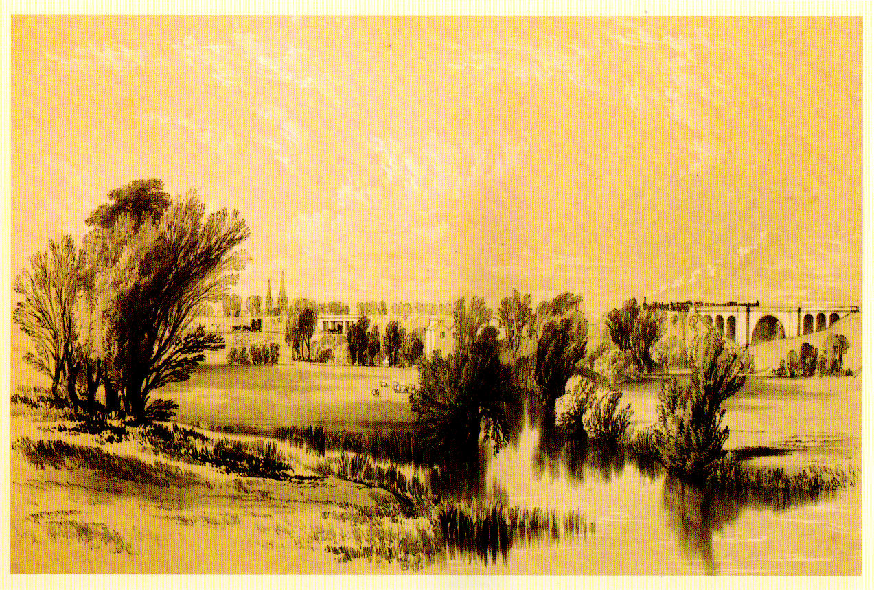
A very similar picture was painted by John Cooke Bourne at the opening of the railway around 1838. On this can be discerned a building which was probably Shortley Mill
This Victorian Sewage Pumping Station was once located near Shortley and pumped the sewage to a site on what is now Baginton Airport. Much of the river had long been a mess as a result of the large amounts of rubbish dumped by the citizens of Coventry.
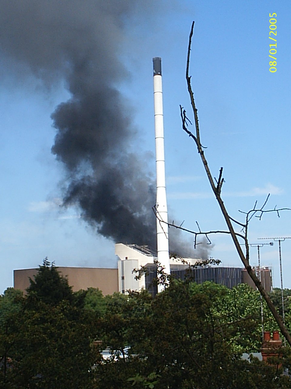
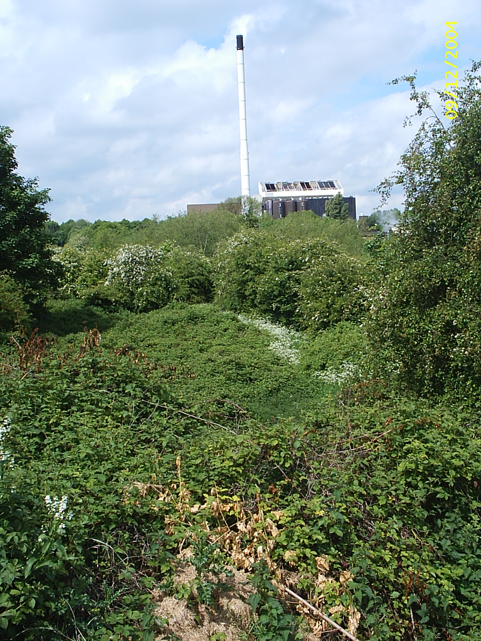
The Coventry incinerator is now on this site and this was the incinerator incinerating itself in 2005.
The Sherbourne is hidden in this jungle and is part of a wonderful wildlife area which used to be the allotments at Shortley. It is to be hoped it will remain thus.
In this area once stood this bridge which formed part of the mill at Shortley. There were several mills in this area and they changed hands so often that the record is quite unclear. There were probably five mills altogther. Courtesey Florence Weston.

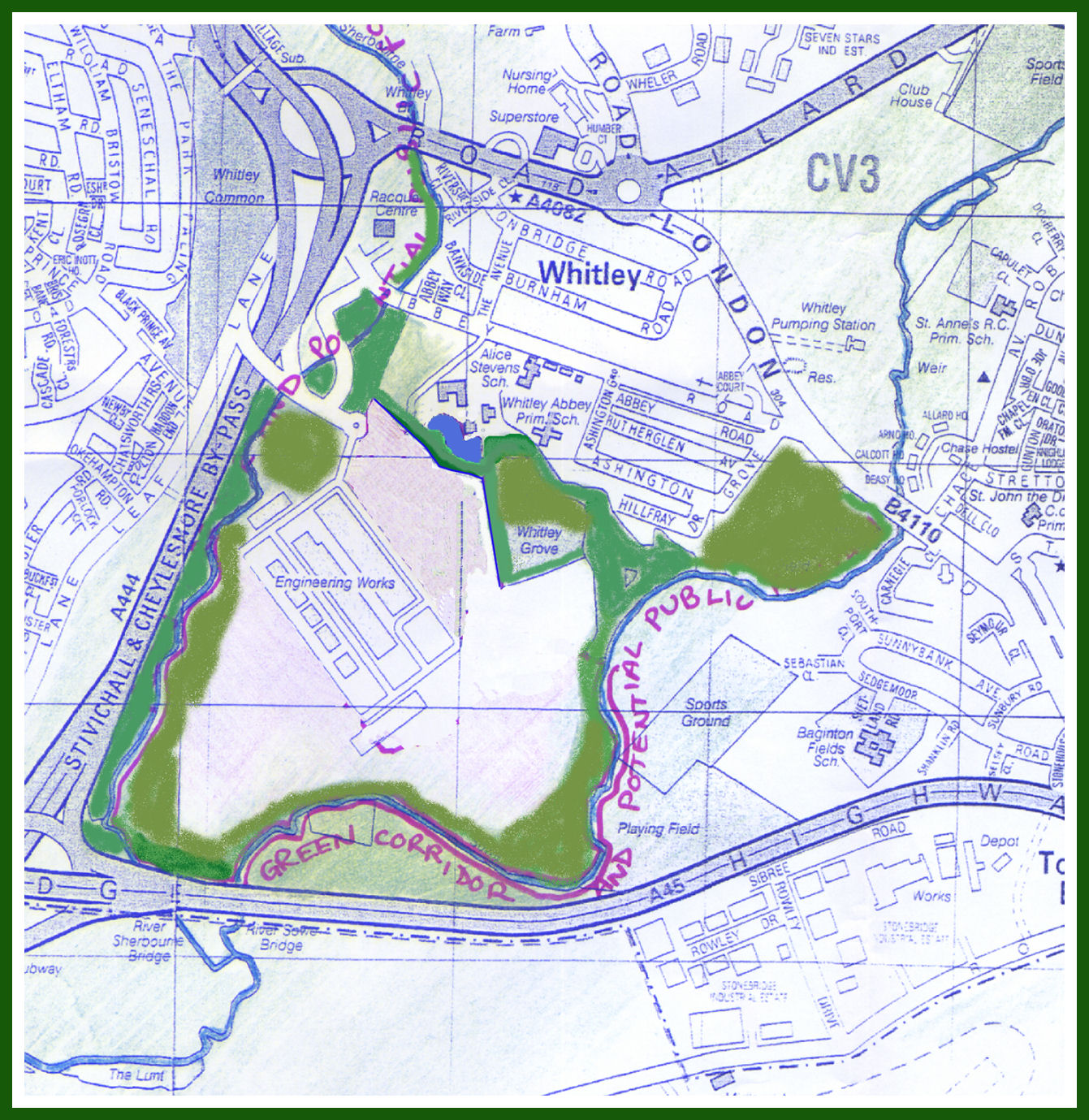
Whitley Mill is on a section of river that runs through a change in bedrock and forms a rather lovely section overshaddowed by the inapropriately designed and sited Raquets Centre. The mill was demolished around 1950.
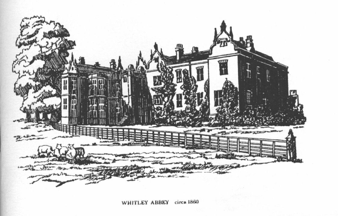
Nearby is Whitley Abbey which was home to the Hood family which gave its name to the famous battleship. It has long been a comprehensive school.
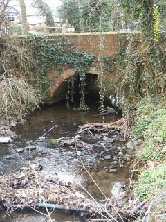
The bridge at Whitley is almost certainly an original Thomas Telford design on the Holyhead Road built around 1815.
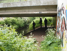
The nearby airfield at Whitley was built by Armstrong Whitworth around 1930 and there they designed and built the Whitley Bomber which was the mainstay of RAF Bomber Command until the Lancaster and Wellington took over that role starting in 1942. Sadly, not a single Whitley bomber remains although there is a wrecked engine in Bamborough Castle. The site is now a design centre for Jaguar and local youths enjoy painting graffitti under the access road.
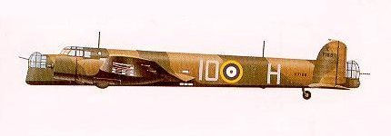
The Whitley Bomber.
Most of the river on the Jaguar site is no longer accessible due to fencing and wild undergrowth but Quinton Pool makes a contribution to the river via a sewer once knonw as Park Brook. There are also trace remains of a mill. The fields on the Jaguar site leading down to the A45 are an amazing wilderness but are, unfortunately, due for development as an industrial site.
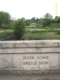
The river now passes under the A45 at the junction of A45 and A46 and joins the River Sowe in these fields looking up to the Roman Lunt Fort at Baginton.
I hope you enjoyed our trip down the River Sherbourne. Coventry almost certainly owes its founding and development largely to the river. While we now dismiss it as not much more than a sewer, in medieval times it was a very useful tool. The six monasteries that were founded in and about the city, St. Mary's Priory, Whitefriars Monastery, Greyfriars Monastery, St. Annes Carthusian Priory, Stoneleigh Abbey and Coombe Abbey all ran sheep and processing the wool made Coventry a very rich city. In the middle ages it was the fourth city in the land and almost the only place outside London that ever held parliament. It played a significant part in The Wars of the Roses and the Civil War and all that depended totally on the Sherbourne for sustenance. I calculated that in flood all the mills together could produce about 25 horse power or the power you use travelling at 60 mph in your car. That was the total power available to a city of about 8000 people.
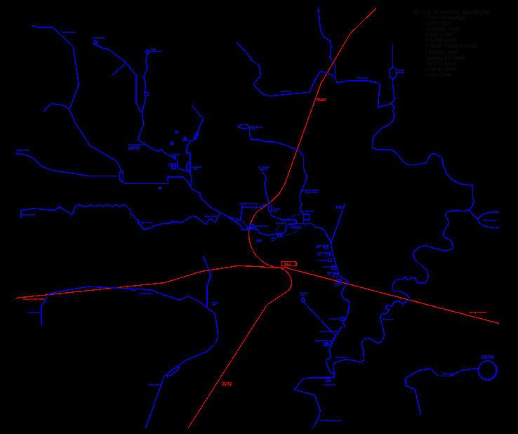
The map below shows all of Coventry's rivers in relation to its railways. The river bottom right is the Avon. Bottom left is Canley Brook. The rolling river to the right is the Sowe with Coombe lake and all the rest form the River Sherbourne.
 ,
,